01dec20
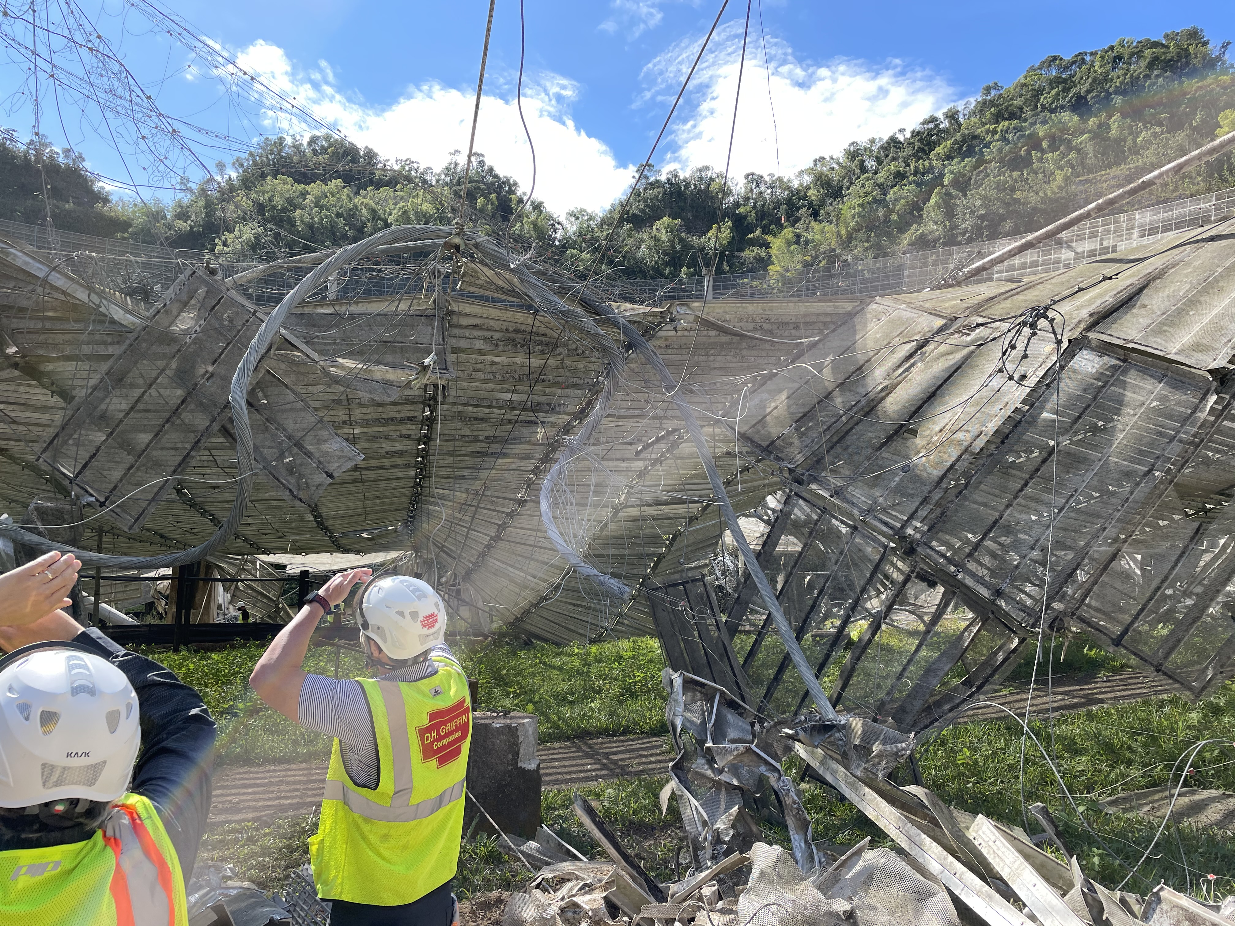
The telescope collapsed on 01dec20 at 7:52:27.6 (last communications with the tilt sensor running in the dome). This page has info on things that occurred after the collapse.
Links:
- list of drone videos after the collapse
- Monitor the stability of the platform and azimuth arm on the ground.
- Some photos after the collapse
- p50 laser scanning
- 201203: scanning the debris in dish with p50 laser scanner
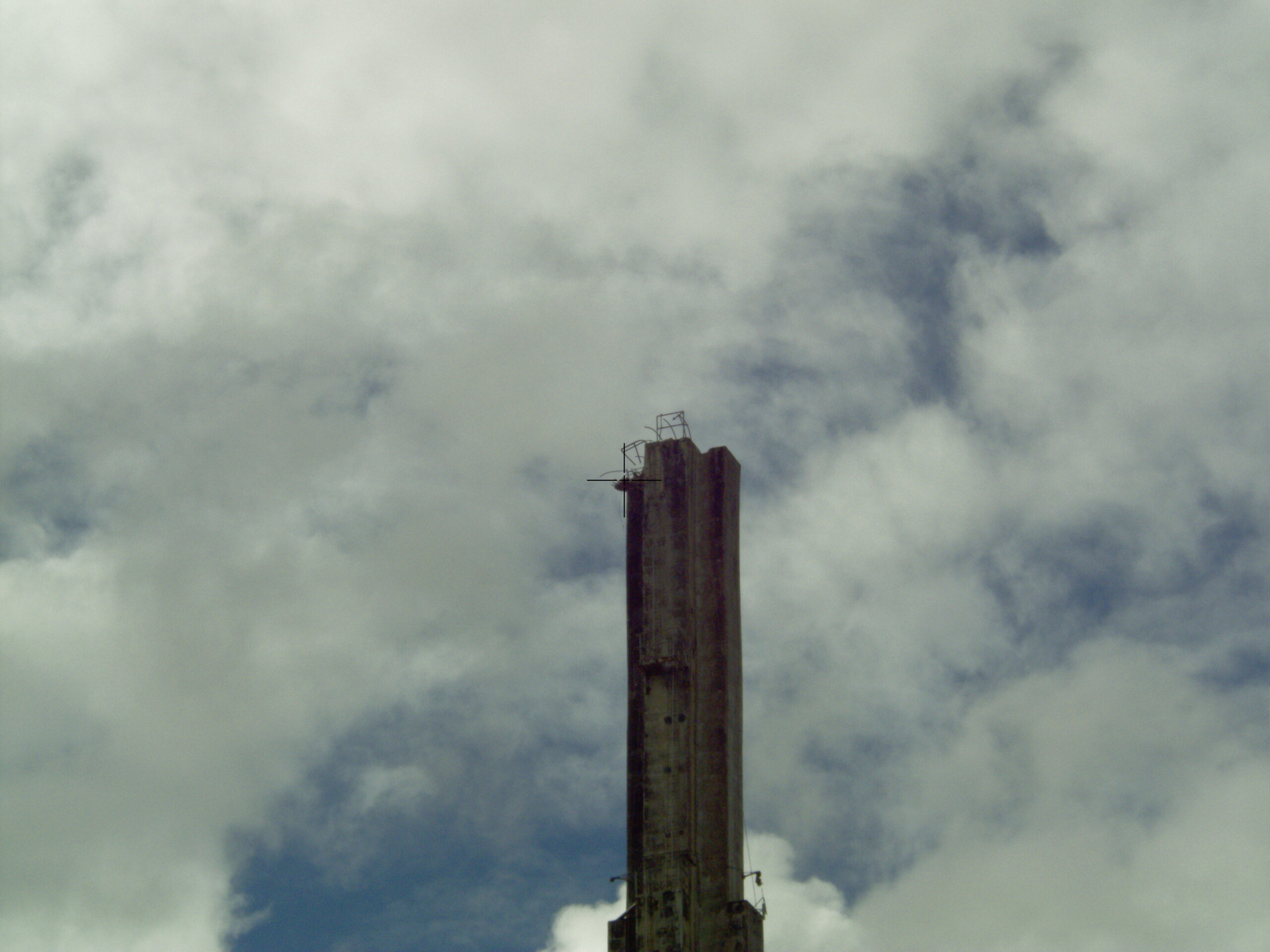
- 201209: scanning the south face of T12
from visitor center balcony
- 201208 : measure distance to span the moat under the dish.
- 201209: how many lead blocks are there to pick up?
- 201217: Scanning the towers after the collapse (are they tilted?)
- 210315: tower, primary,and paraxial surface locations
- 210506:
compare a parabola, catenary, and sphere spanning the AO
dish.
Monitor the stability of the platform lying on the ground
Note: The motion
that started on 12dec20 is from the motion of the
reference prisms and the theodolite, not the debris.
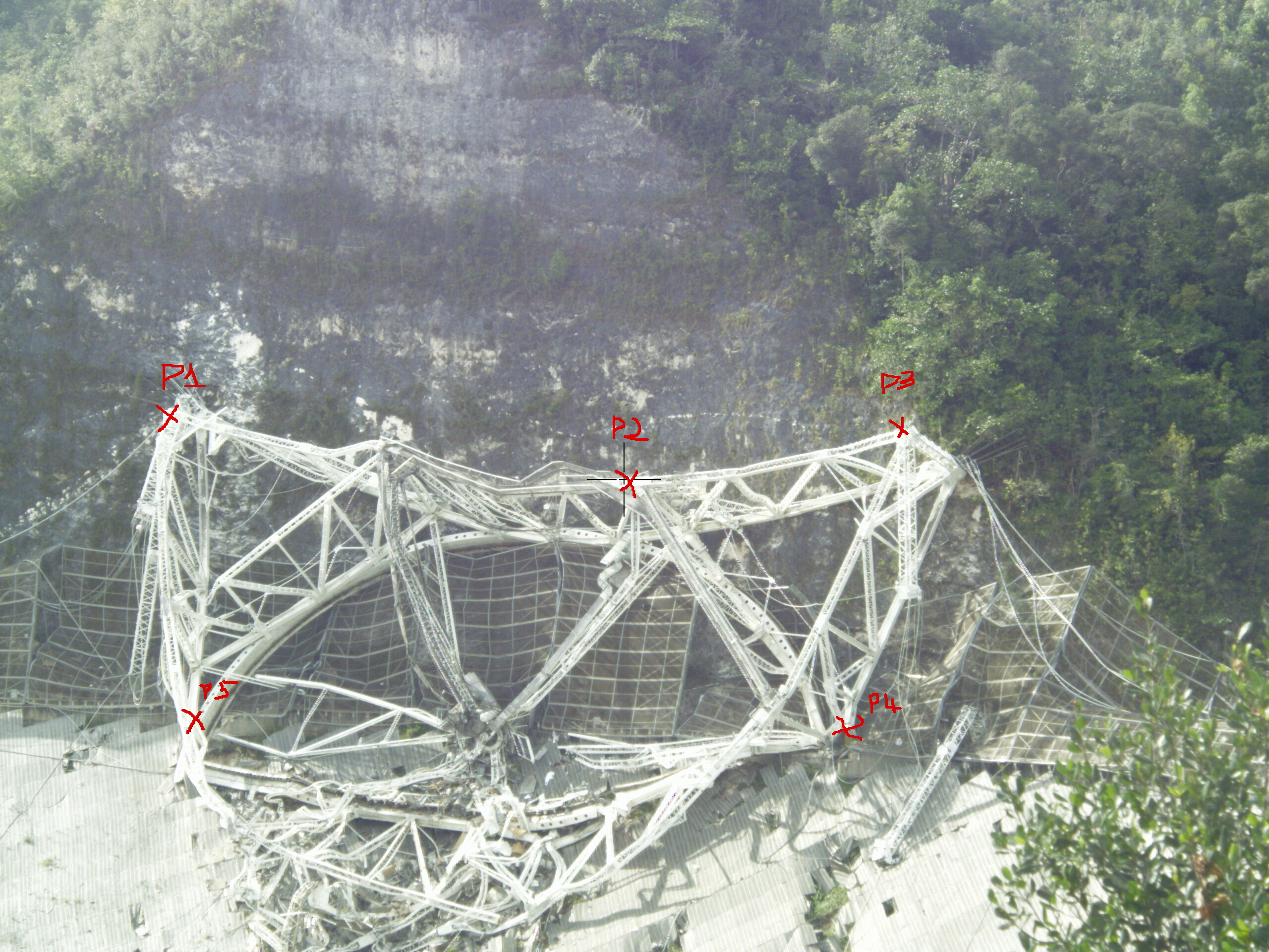
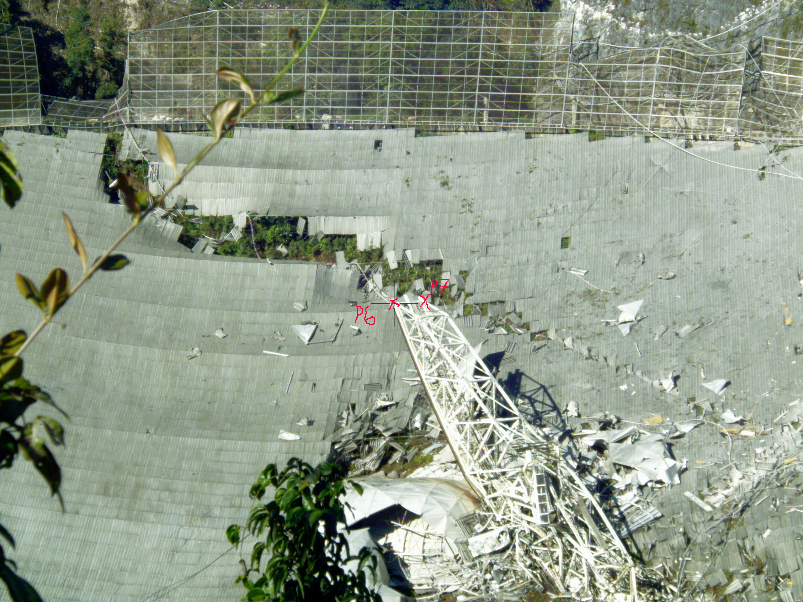
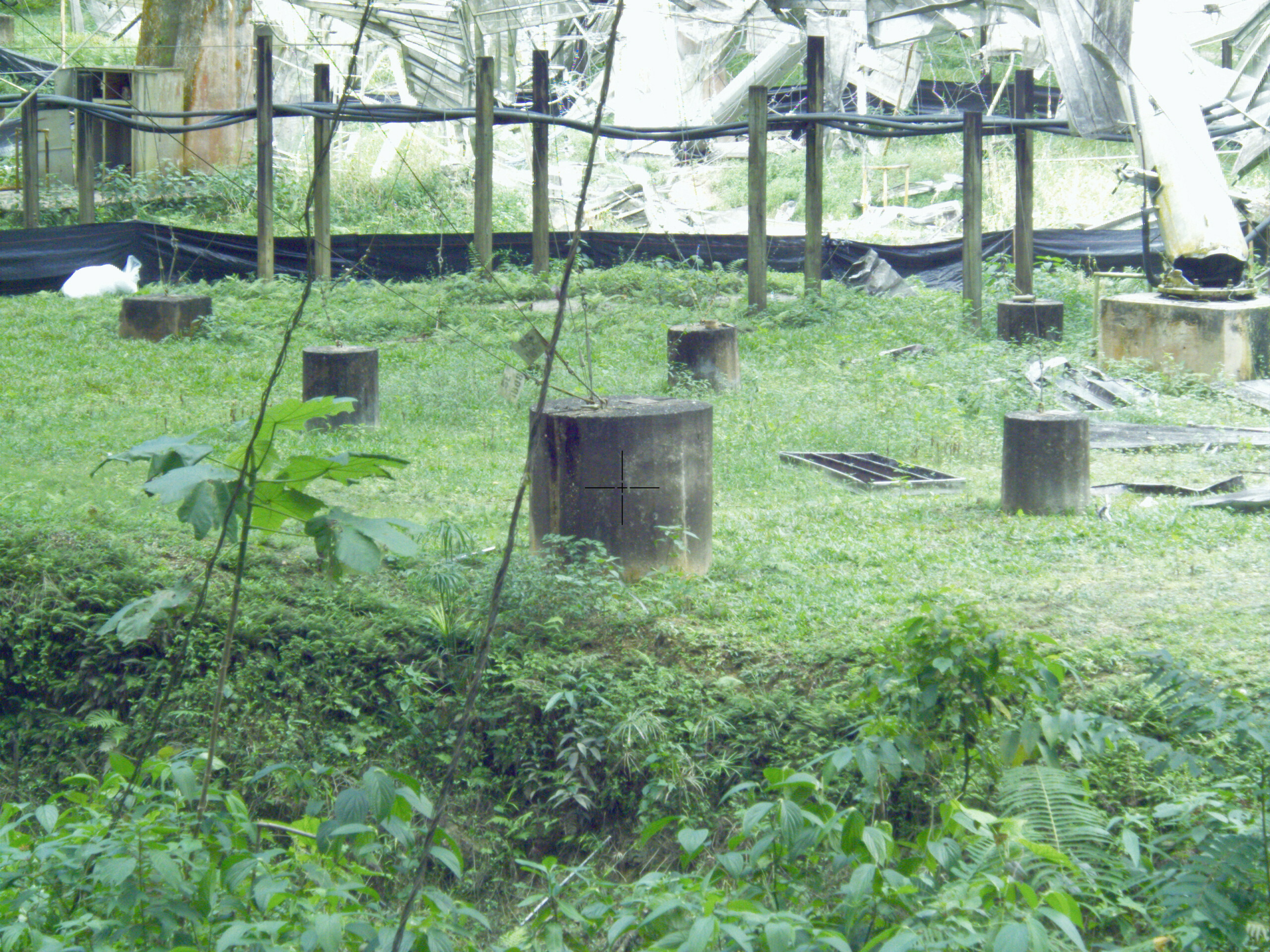
Every day felix and I shoot 5 points on the platform
and 2 points on the end of the azimuth arm to see if the
debris is moving. We sit at the helipad and shoot across
the dish to the platform and az arm on the far side of the
dish (about 350 meters). We are measuring to a reflectorless
surface (no prisms). We've chosen mainly bolt heads for the
points.
The points are label P1-P5 on the
platform, and P6-P7 on the end of the azimuth arm. The images
below show the locations of the points.
Locations of the reference prisms. North defines the azimuth
for the theodolite.
| prism |
x meters |
y meters |
z meters |
Az deg |
| north |
0 |
17.32 |
-.128 |
0 |
| east |
38.187 |
6.865 |
-.021 |
79.807 |
| South |
37.296 |
-17.188 |
.410 |
114.743 |
How the
platform/azarm has moved as they sit on the ground (.ps)
(.pdf)
Dates of interest:
- 201210: switched tripod aluminum to wood
- 201212: excavator cut path through middle of azimuth arm
to get to north side.
- Note: 10Dec20: we switched theodolite stands from
aluminum to wood.
- I used the average position of the 3 ref prism to
compute an xyz correction. Even after that it looks like
the wood versions are about 5cm high.
- The vertical axis is the distance each point has moved from the first measurement (02dec20f for platform, 4dec20 for az arm end)
- We've found that the theodolite tripod (aluminum legs) is changing orientation with temperature (especially at sunrise).
- A wooden tripod with a prism is used as the azimuth reference.
- We set azimuth 0 by looking at the prism, measure the points, and then come back and remeasure the reference prism.
- To correct for the theodolite tripod az motion, we
rotate all xyz points by 1/2 the az motion of the
before/after reference prism measurements.
- The colors separate out the points measured on each day.
- Page 1 radial motion points.
- Top - radial motion of platform points P1-P5
- bottom - radial motion of the az arm tip, points P6-P7
- Page 2,3 x,y,z motions of platform (page 2) and tip of azimuth arm (page 3)
- X-east, Y north, Z up vertically
- The reference prism that set the theodolite azimuth 0 was measured to be 65 deg east of Magnetic north
- I've used magnetic north 13deg west of true north.
- Page 4: diagnostic looking at the azimuth angle for the measured points and the reference prism.
- Top,Middle, change of the azimuth angle for the platform
and az arm points (without azimuth correction)
- Bottom: stability of the northern reference prism that is used to define azimuth 0
- The az 0 is set by looking at the northern reference prism
- After measuring the platform,azimuth points, we remeasure the northern reference prism
- If nothing has changed, this should still be at az=0
- The bottom plot shows the azimuth angle of the 2nd measurement of the reference prism.
- On 7dec20 morning we started to see large changes in
the azimuth reference angle.
- We could see the level angles change as the sun differentially heated the tripod legs.
- The red line shows the azimuth correction we are doing to all points (this is 1/2 the daily azimuth difference that is measured).
- Page 5: Diagnostic :check to see if the reference prisms
have the same relative locations day to day
- Each day compute the az, and xyz difference between the various prisms
- RefPrism north is used to define the azimuth for the
measurements.
- Top: change in azimuth each day. I've removed the median
value of each set for plotting.
- black: RefPrismEast - RefPrismNorth
- Red : RefPrismSouth - RefPrismNorth
- green RefPrismSouth - refPrismEast
- On 12dec12 E-N, and S-N show a progressive daily change. S-E is stable. So the North prism is suspect
- 2nd Frame xyz change East - north
- on 12 dec the y value (pointing at North Prism starts to drift)
- 3rd Frame: xyz change South - North
- on 12dec x and y start to show a drift
- bottom frame: xyz change South - east
- this also shows a drift in the x direction starting on 12dec.
- Page 6: plot xyz locations of the reference prisms over time. Remove the median value for plotting
- Note that the azimuth for the theodolite is set by
the daily measurements of refPrismNorth. any day to
day azimuth motion will not be seen (but will show up in
the other 2).
- top: xyz refPrism North
- if the refNorth moved away from the theodolite, the y
value would increase.
- middle: xyz refPrism East
- bottom: xyz refPrism South
- On 12dec20 the centering of the theodolite above the survey marker had moved relative to the center of the tripod. the motion is in the negative Y direction.
Measurement errors:
- TM50 errors:
- Angle error: .5 asec --> .8 mm At 350M.
- Our angle error is much larger:
- we don't have a prism we are shooting off of, so aligning with the bolt visually causes extra error.
- Distance error:
- on reflectorless measurements: 2mm + 2ppm . at 350 meters->2.7mm
- Our distance error will be worse since we may not
perfectly center on the bolt head or auxpin center. The
laser spot size is larger than the bolt head.
- Size of laser beam at 350 meters.
- the laser beam spot size is 5.6 x 8.75 cm at 350
meters.
- I assume that the receive ccd will find the center of the returned signal to a lot better than this.
- Position, level/tilt adjustment of the theodolite
- We position the theodolite above the survey marker at the helipad with the tm50 positioning laser.
- The tm50 is then leveled using its digital bubble
- The measurements are then automatically corrected for
any level errors during shooting.
- Reference frame error.
- We are using a tripod with prism on top to set our
azimuth for each day of shooting.
- The tripod is about 17 meters away. a 1mm error at the tripod would make a 2.5 cm error at 350 meters.
- What is the largest error?
- 08dec20: found that largest error for morning shots is
the aluminum tripod we are using. At sunrise the legs are
heating differentially causing tilt errors.
processing: x101/survey/pltlow/pltdat.pro, getdata.pro
P50 laser scanning
| date |
object scanned |
p50 loc |
setup |
size |
.las file |
Notes |
| 201203 |
dome/platform in dish |
helipad |
maxrange:570m resolution: .8mm @ 10m high intensity |
370MB |
pltlow_201203.las |
|
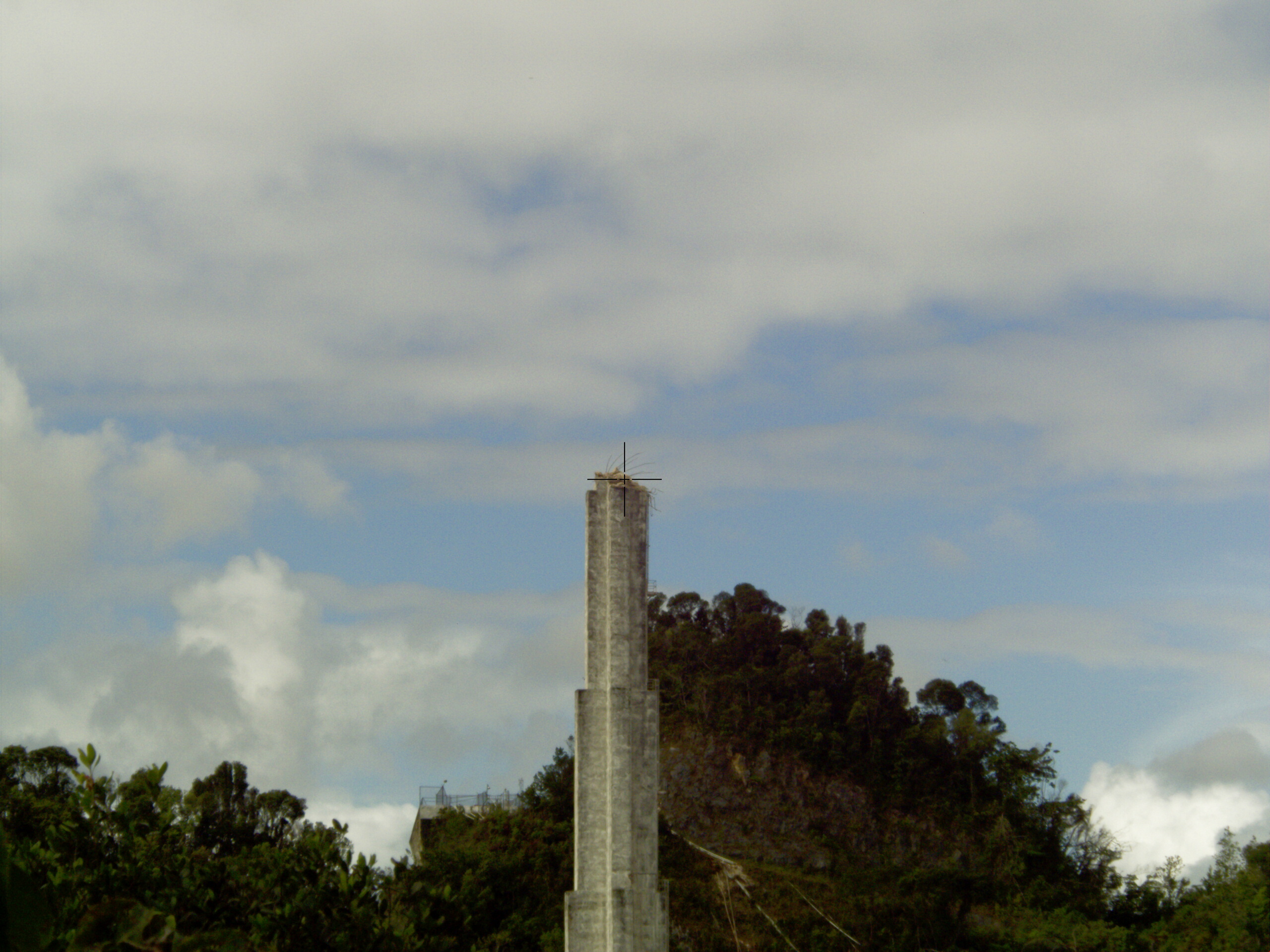
| 201209 |
Tower 12 south face To check plumb |
visitorCen balcony |
maxrange:120m resolution: .8mm@10m high intensity |
2.2GB |
t12_201209.las |
processing: x101/p50/2012xx/
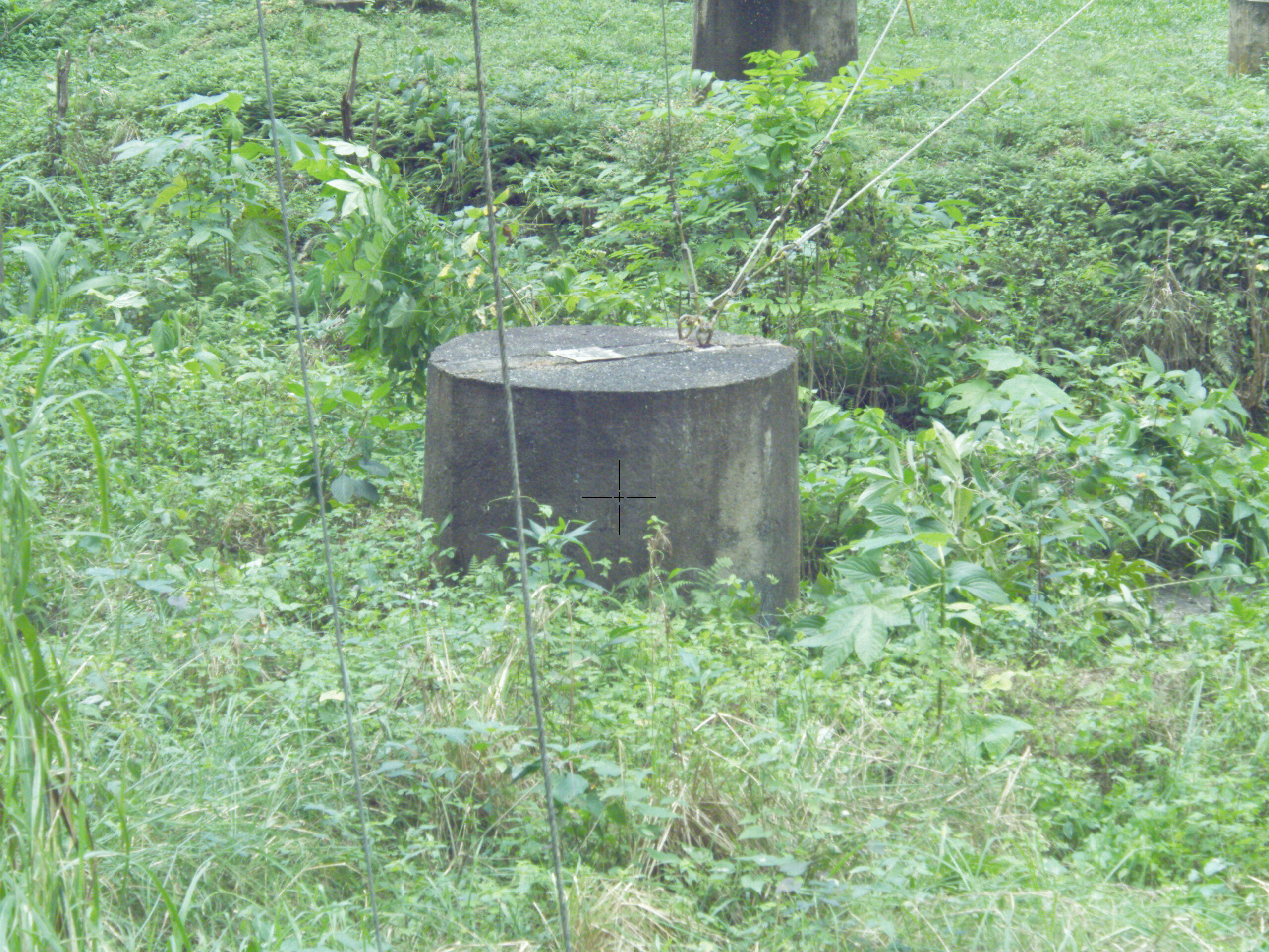
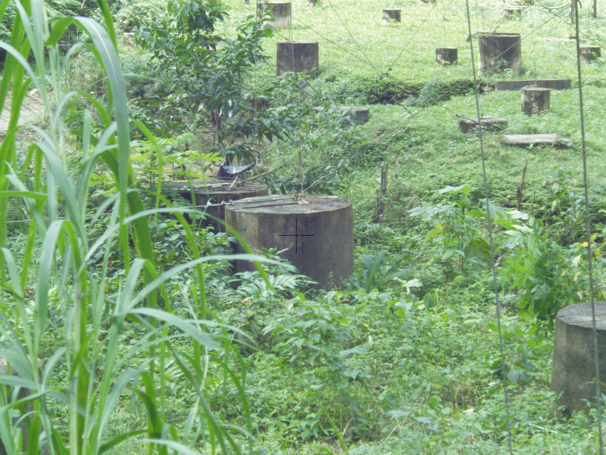
201208 Distance needed to span the moat
The location of 4 tiedown blocks were measured to see what
was needed to span the moat.
The block orientation is

| distance Feet |
block 1 |
block 2 |
|
| SE to NE distance |
49.7 |
SE image |
NE image |
| SW to NW distance |
50.4 |
SW image |
NW image |
The cross hair shows where on the block the measurement was
made.
processing: x101/survey/moat/printmoat.pro
201209: how many lead blocks are there to pick up
| size |
count |
pictures |
| 195 lbs bars |
195 |
.jpeg1
.jpeg2 |
| 25 lbs dumbbells |
66 |
|
| 10 lb round pieces |
about 117 |
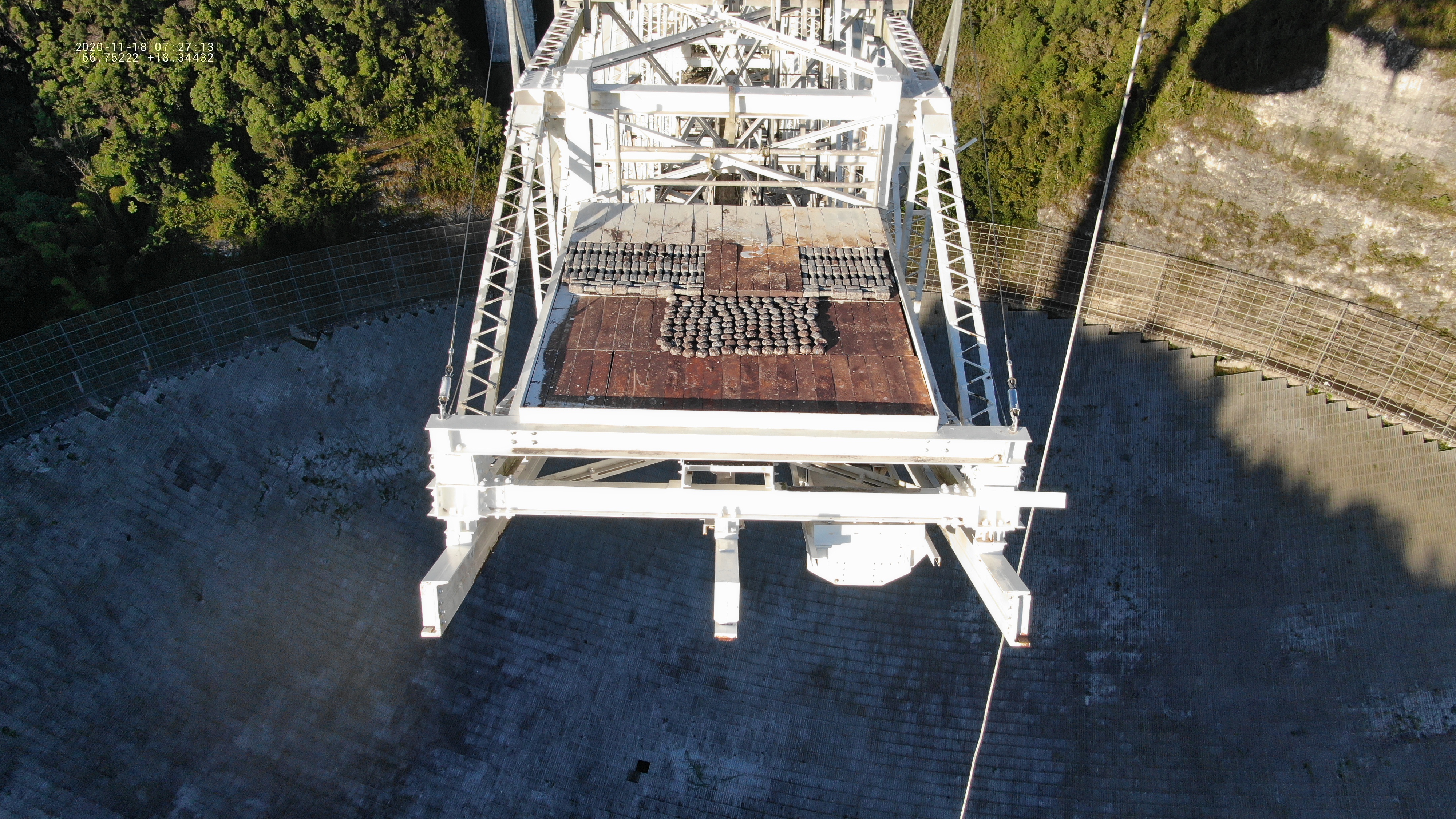
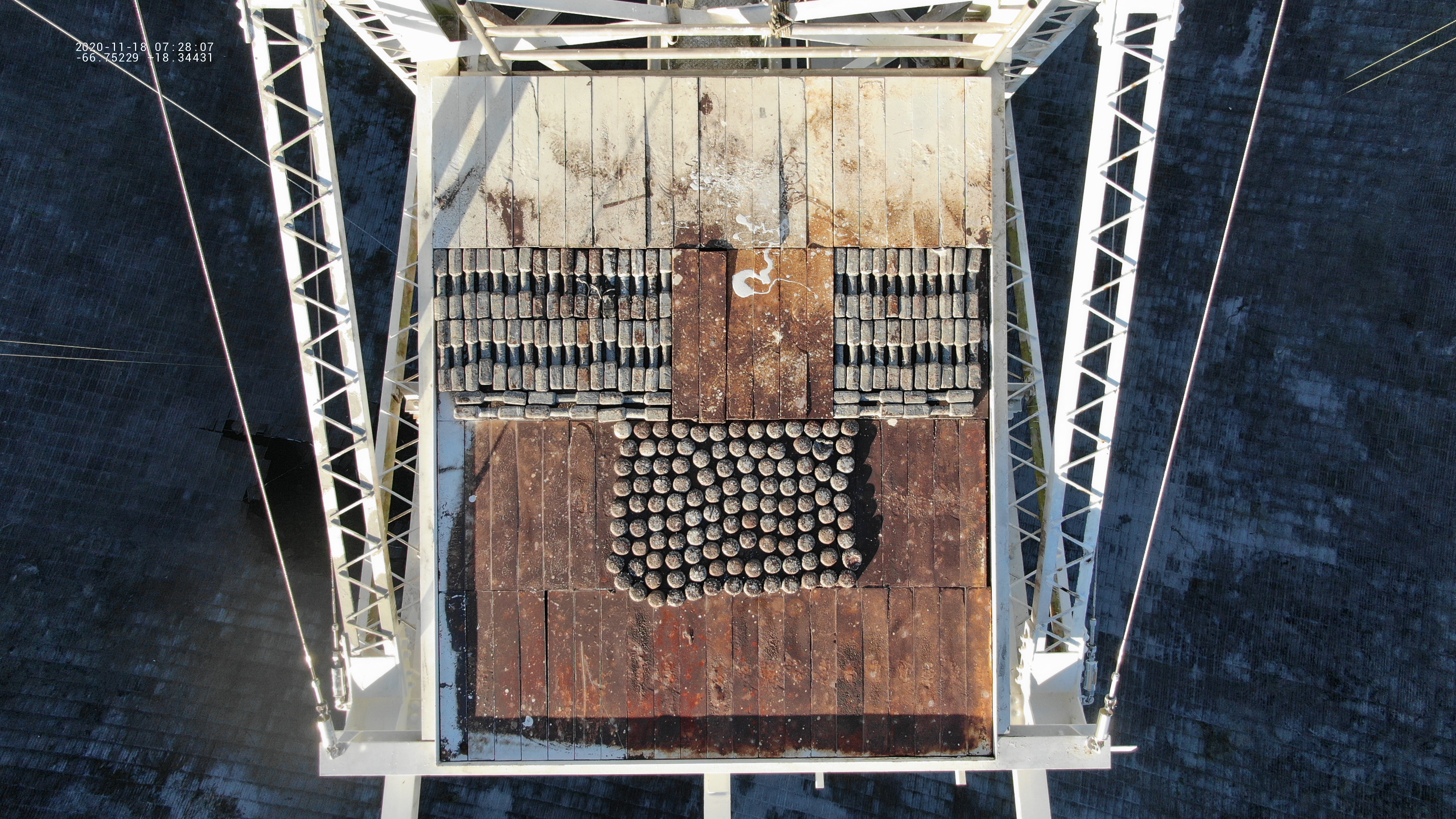
Notes:
- 195 lb bars
- 21 bars/row, 4 rows/level, 2 levels, 1 complete extra row, + 6 bars
- 21*4*2 + 21 + 6 = 195 bars
- 25 lb dumbells
- right side: 11*2 + 4, left side 17*2 + 6
- 11*2 + 4 + 17*2 + 6= 66
- round pieces:
- about 117 (but i got tired of recounting them :)
Some photos after the collapse
| date |
object |
links |
notes |
| 201204 |
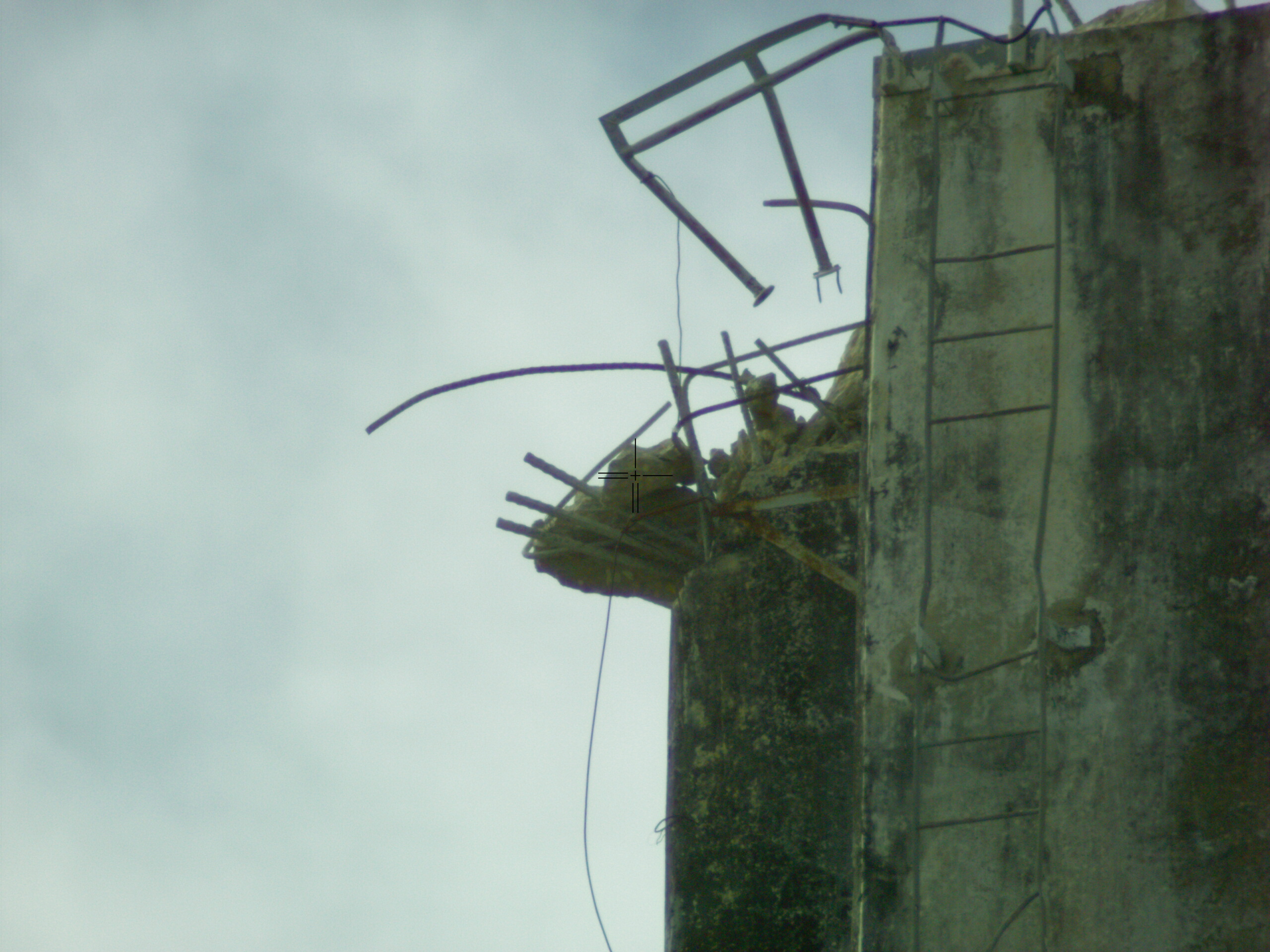
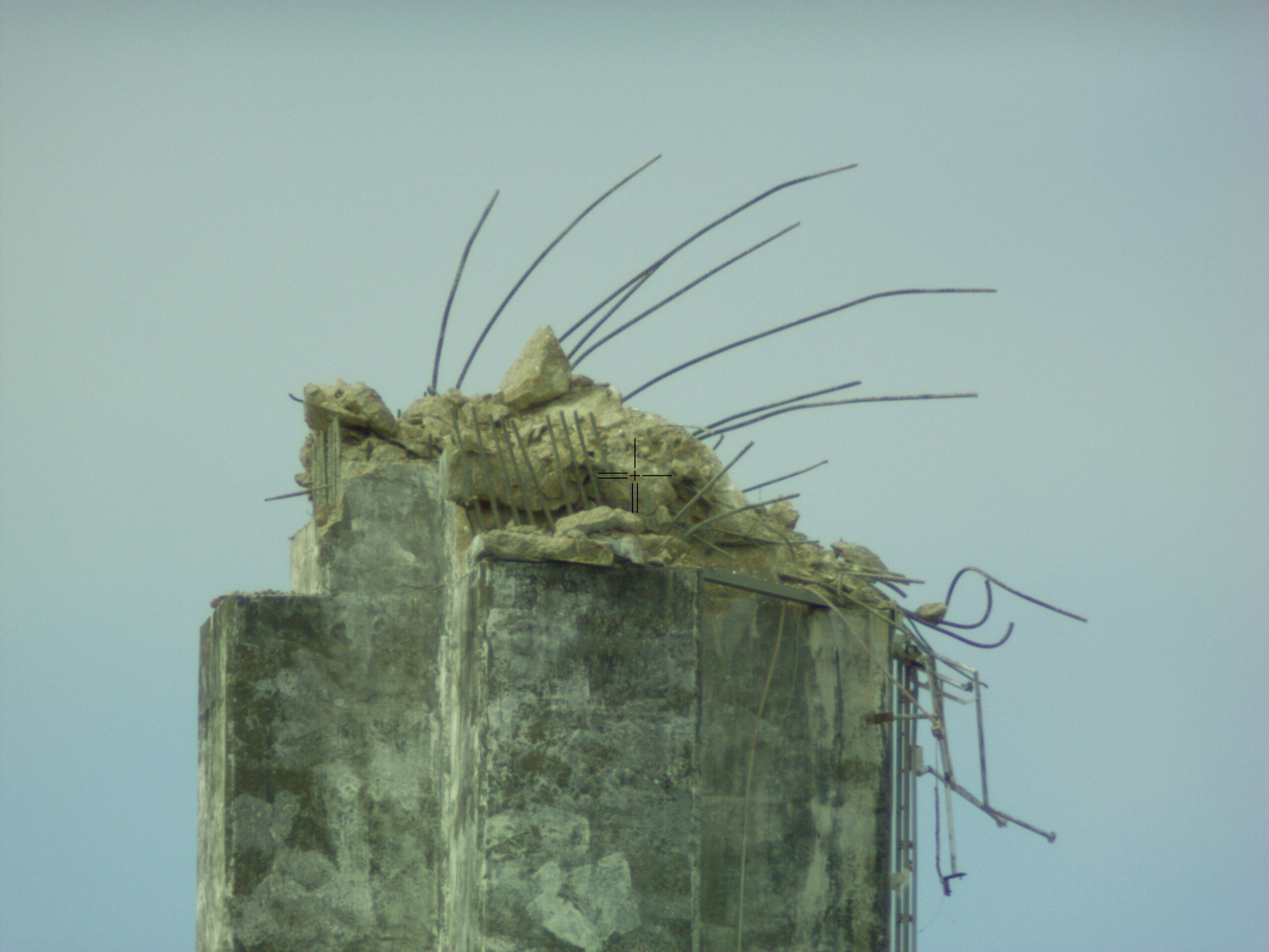
tops of tower 4,8 |
t4LowRes
t4Hires t8lowRes t8Hires |
Shows loose rocks at the top. taken with theodolite from helipad |
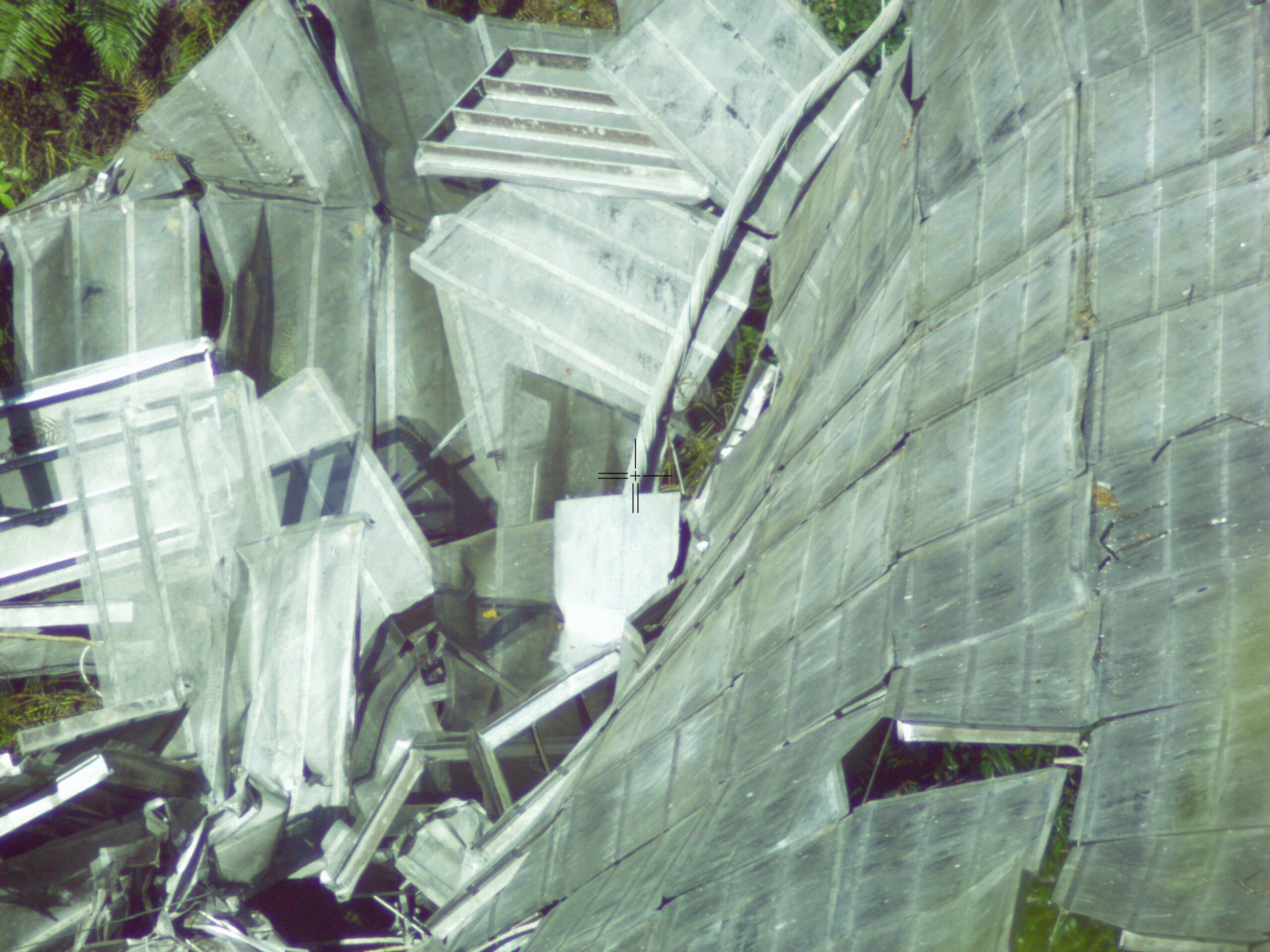
| 201208 |
T4auxN on dish T4AuxN end in dish |
lowres
hiRes .jpeg |
Want to save end of this cable for
analysis. taken with theodolite from helipad Shows end hanging in dish |
| 201208 |
lead blocks under dish |
.jpeg |
by end of azimuth arm. |
Primary, paraxial surface, and
tower locations
I made a drawing of the primary, paraxial
height, hf mesh, and tower heights (original and current) to
give people and idea of where the current tower heights
(mar21) are relative to the other surfaces.
Drawing of primary,paraxial surface,
and tower heights (.ps) (.pdf)
- all dimensions are in feet
- the black line is the primary.. I've extended it way beyond the edge of the dish
- Light blue: the hf mesh. i made it spherical rather than parabolic with max extent of 374ft
- green paraxial surface
- * red center of curvature
- blue rectangle: towers
- t12 an T4 have the same base
- t8 has a different base
- the dashed red lines show the current height of the towers. I've assumed that T12 and T4 both lost 60ft.
- purple dotted lines every 100 ft.
Numbers used:
hasl = height above sea level
| height center of curvature |
1630ft hasl |
| radius of curvature |
870ft |
| height center of primary |
760 ft |
| radius paraxial surface |
435 ft |
| horizontal radius to towers |
700 ft |
| height of original towers |
1386.5 ft hasl |
| height base of t12,T4 |
1133 ft (top of foundation) hasl |
| height base of T8 |
1018 hasl |
| t12,t4 missing height |
60 ft ( an approximation) |
| t8 missing height |
120 ft |
| distance hf mesh from botom dish |
284 ft |
| zenith angle edge of dish |
35 deg. |
processing: x101/210316/towerplot.pro