25may19
Links:
Intro
How
i think the fmcw lidar measures distance
may18 survey
- What was done
- 21may18 looking around
- 22may18
placing targets on rim wall, visitor center balcony
observation
- 23may18 road between anchor 4 and gate to river
- 24may18
ao9 and visitor center
- Some
pictures of the scanner locations
- Numeric values needed for calibration
- Measuring the location
of the rim wall targets with the leica theodolite
- scanner orientation (.png)
- rotate to north, include
main cables (.png)
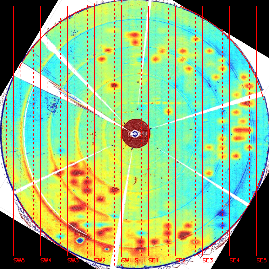
- Each vertical red line is a main cable (spaced every 25
feet)
- A number of the points are centered on a main north,south cable.
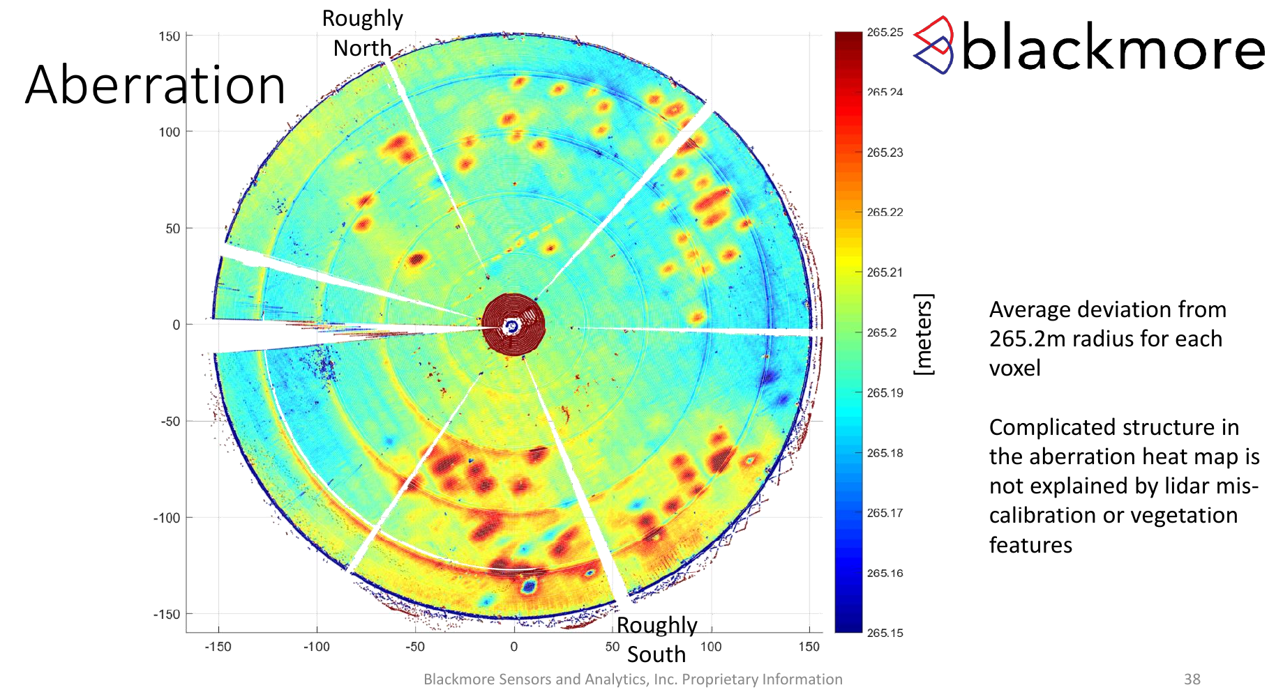
- processing: x101/blackmore/aberration.pro
- Photos
taken of the dish 16jun18 from rim road, ao9.
Blackmore presentations/reports:
- These presentations/reports may contain proprietary info from Blackmore.
- Access is limited to the internal AO network.
- Blackmore presentation introducing their technique (.pdf)
- Blackmore summary report of the survey (.pdf) 17MB
- This includes photos taken during the survey, images constructed from the scanner, and their conclusions.
- blackmore jul18
update (.pdf)
Intro
Blackmore sensors makes an FMCW
lidar that can be used to scan areas. We are exploring using
this scanner to measure the dish surface accuracy. If it works,
this would greatly simplify the data acquisition. Previous
measurements used photogrammetry from the towers.
Photogrammetry entailed:
- placing a target on each panel (38000+ panels).
- to redo a photogrammetry survey we would probably first have to remove the old degraded targets
- Take 30 to 50 9" photographs from each tower,
- each photograph had about 18000 targets on it.
- the locations of the targets on each photo was measured
on an optical measuring machine (to a few micron
accuracy).
- This took about 6 months.
- A blackmore scan from say ao9 would take about 1 hour... no need to put targets on the dish.
The May18 survey
Blackmore sensors surveyed the primary reflector and telescope with their FMCW lidar scanner 22-24 may18What was done:
21may18:
- 4 possible locations were inspected:
- visitor center balcony
- upper road between anchor 4 and gate to rio tanama (by tony's old camera stand)
- midway up the road between the base of tower 8 and the turn to go to anchor 8.
- AO9.
- Maintenance cleared brush in front of the anchor 4 road, and the base of tower 8 road.
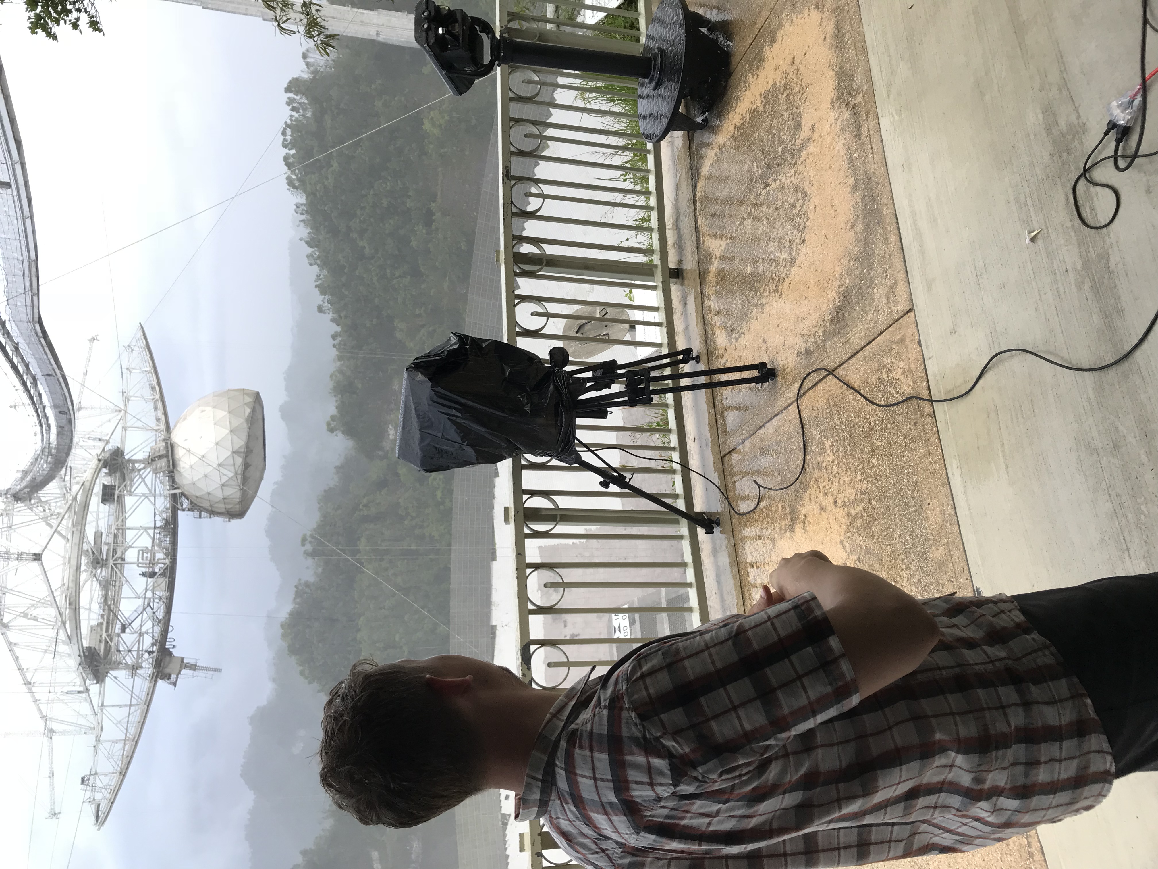
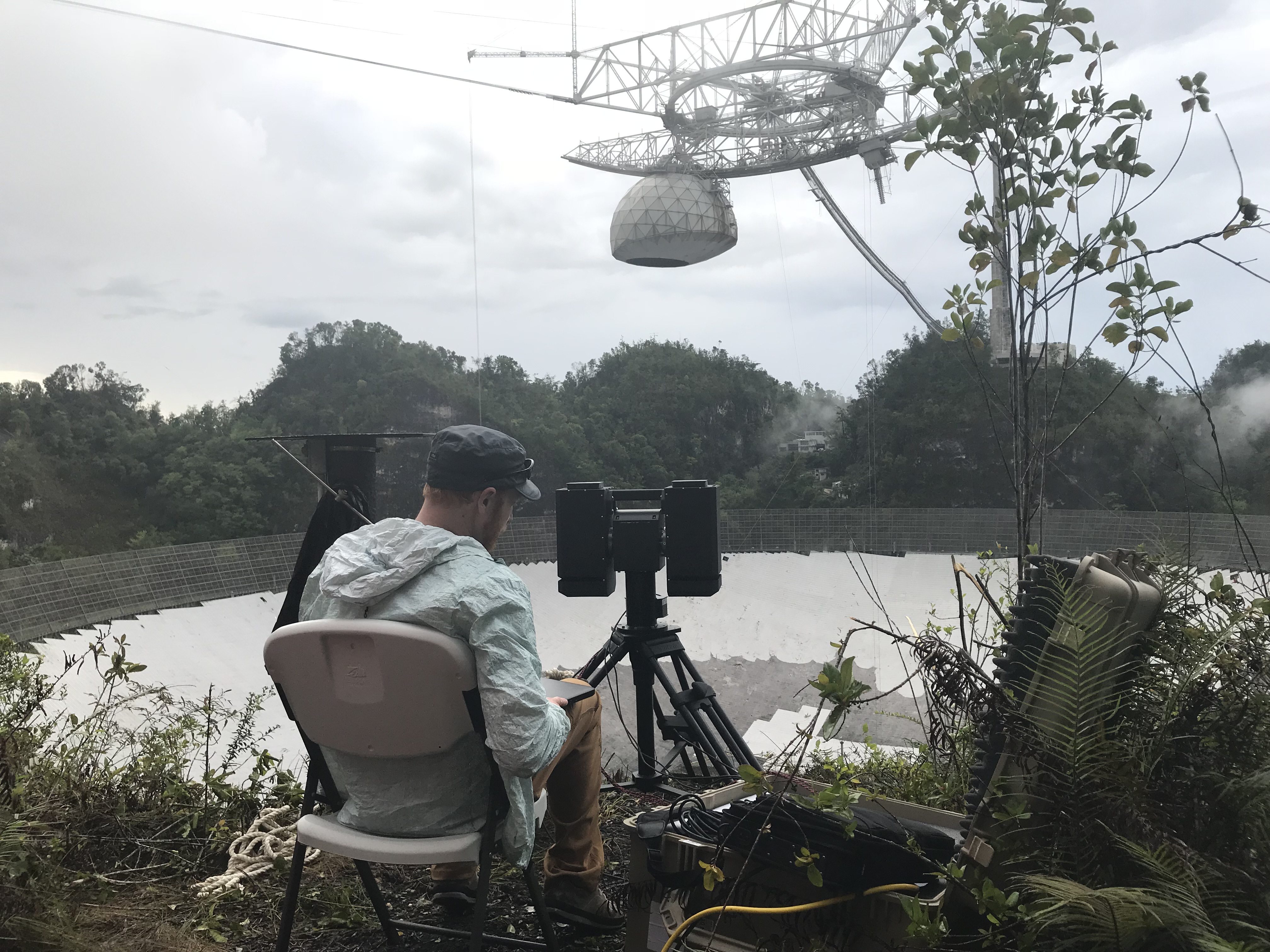
22may18 - visitor center balcony
measurements
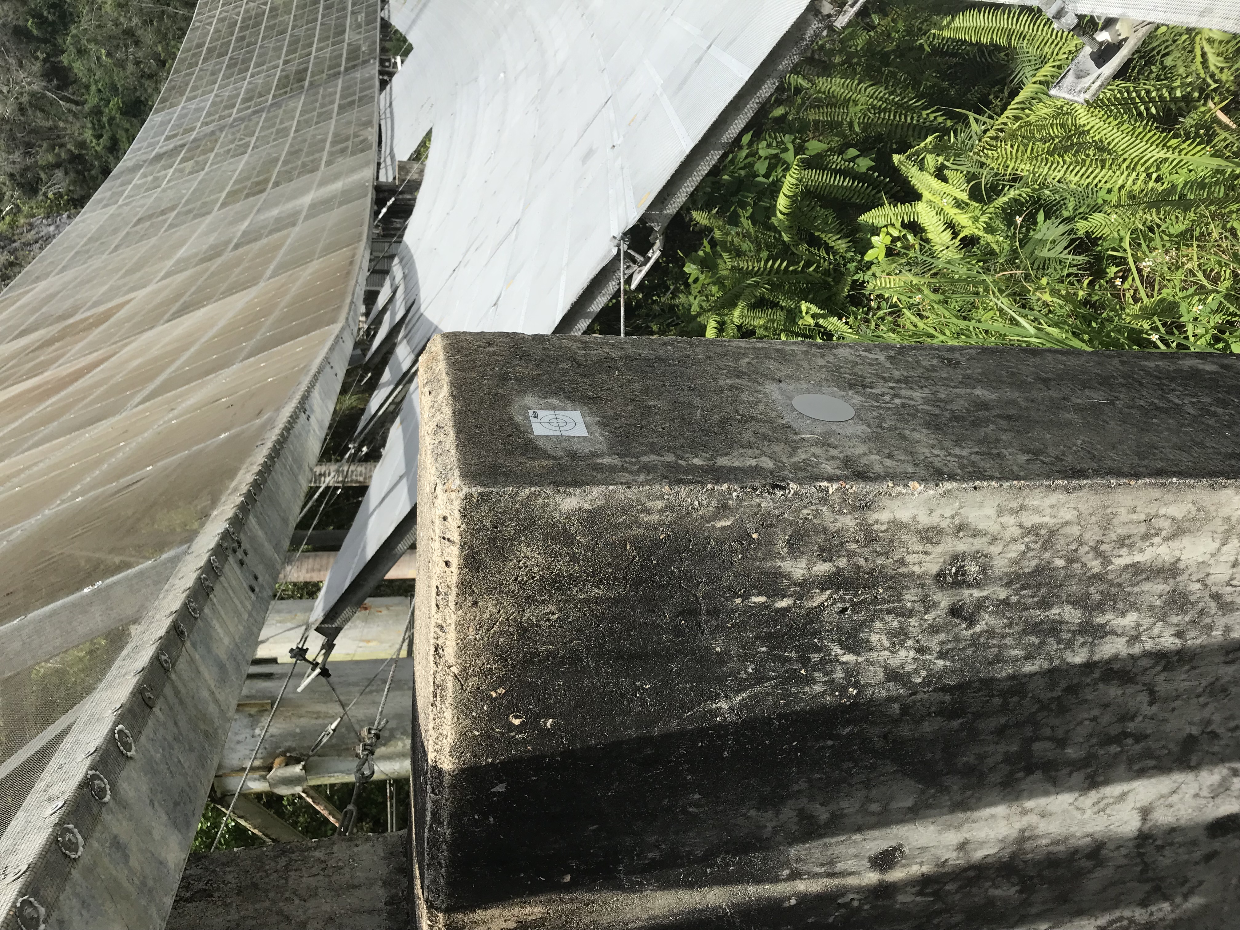
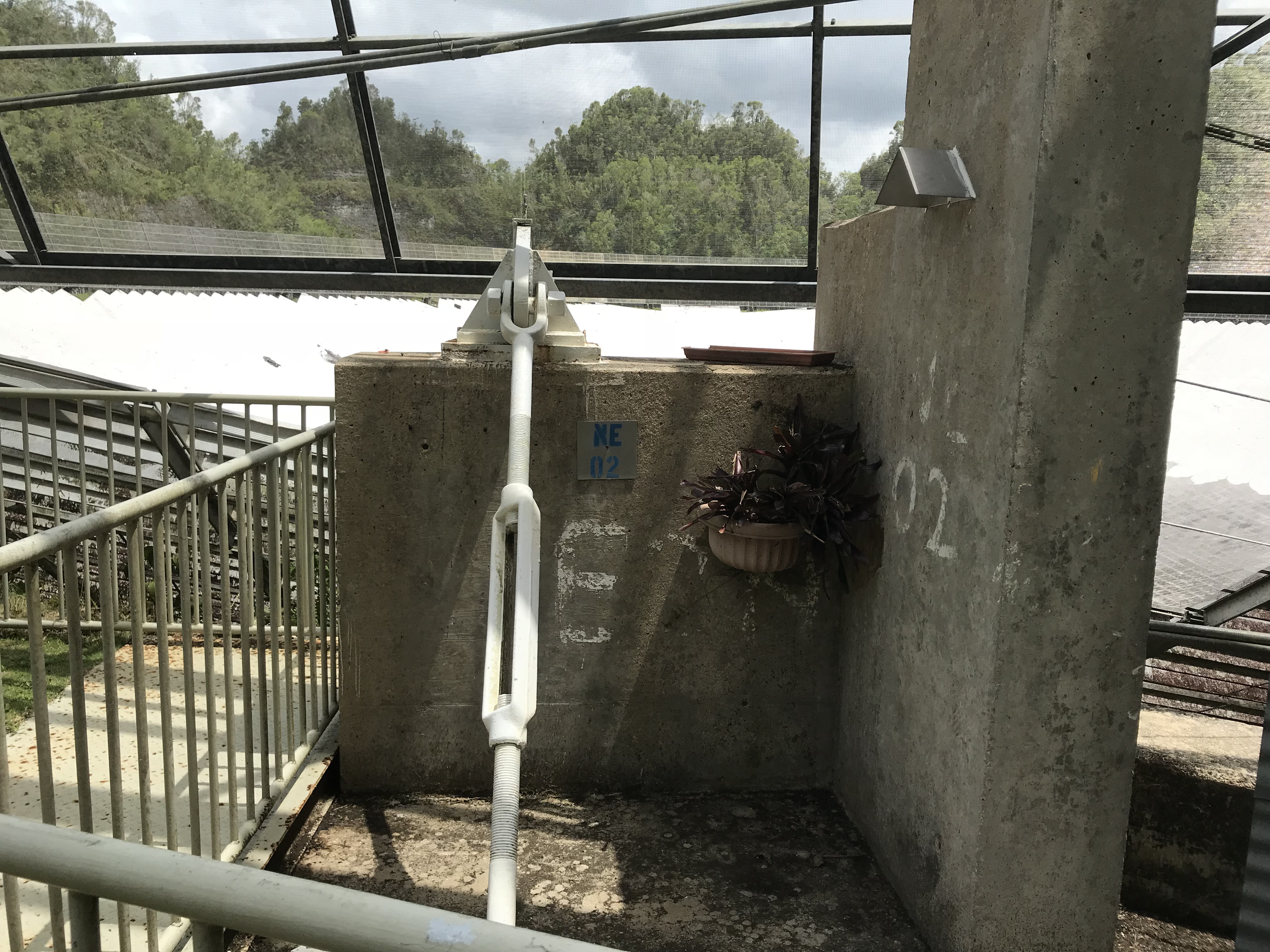
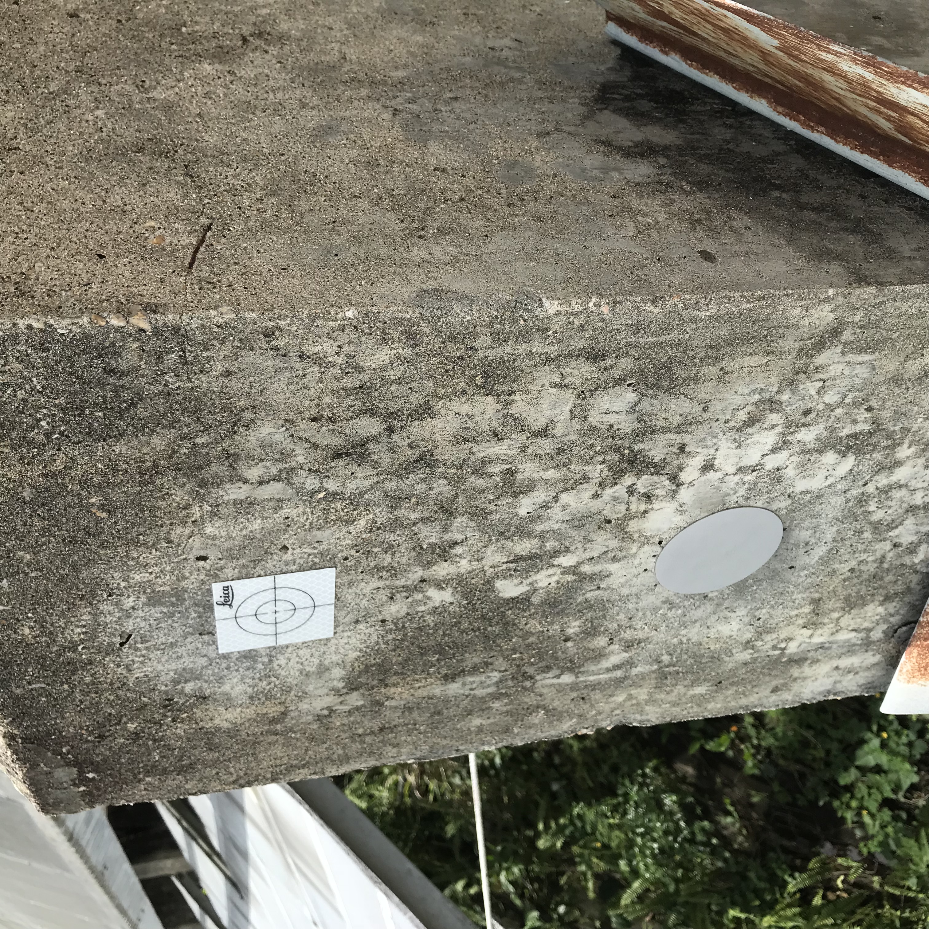
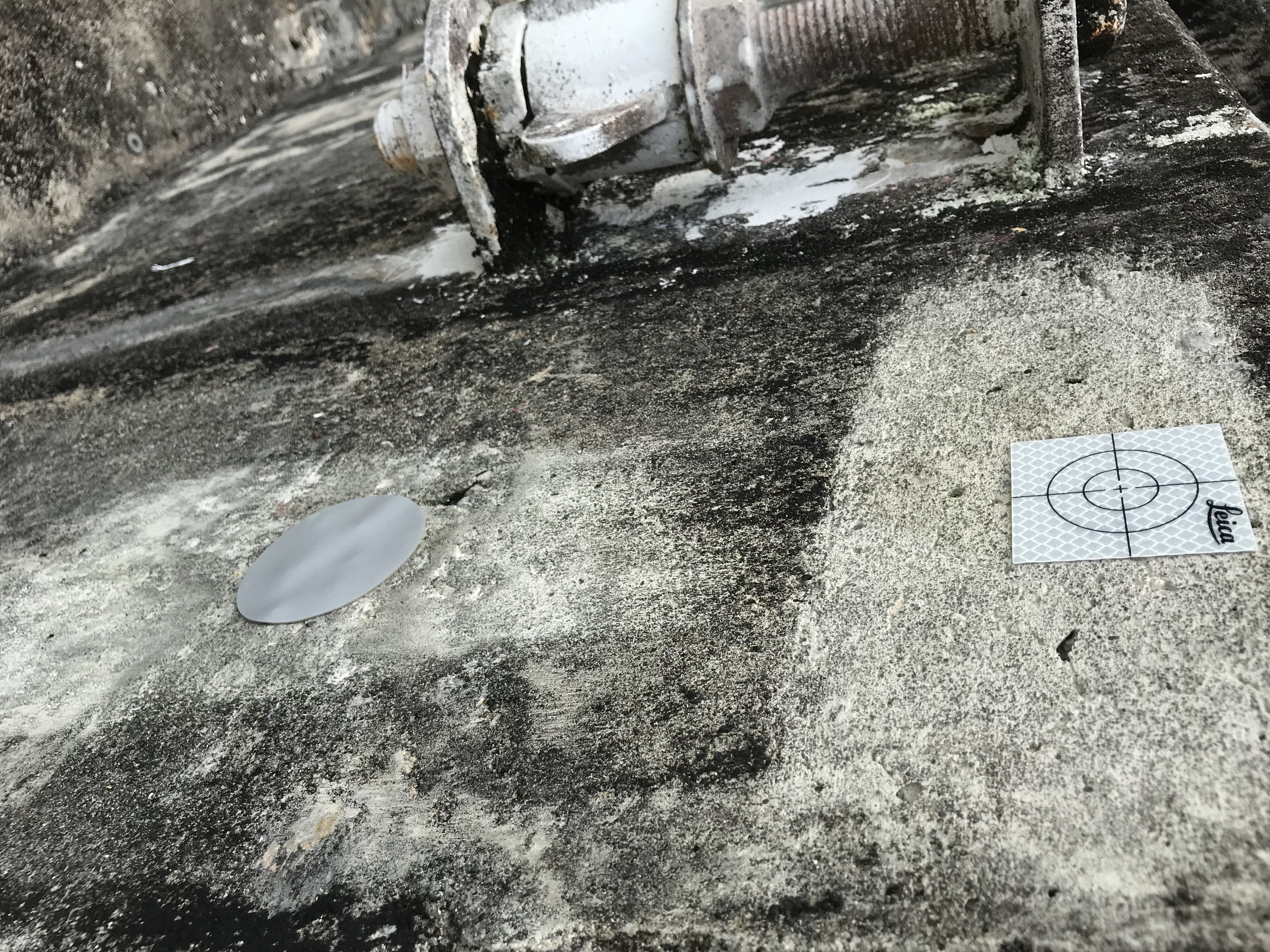
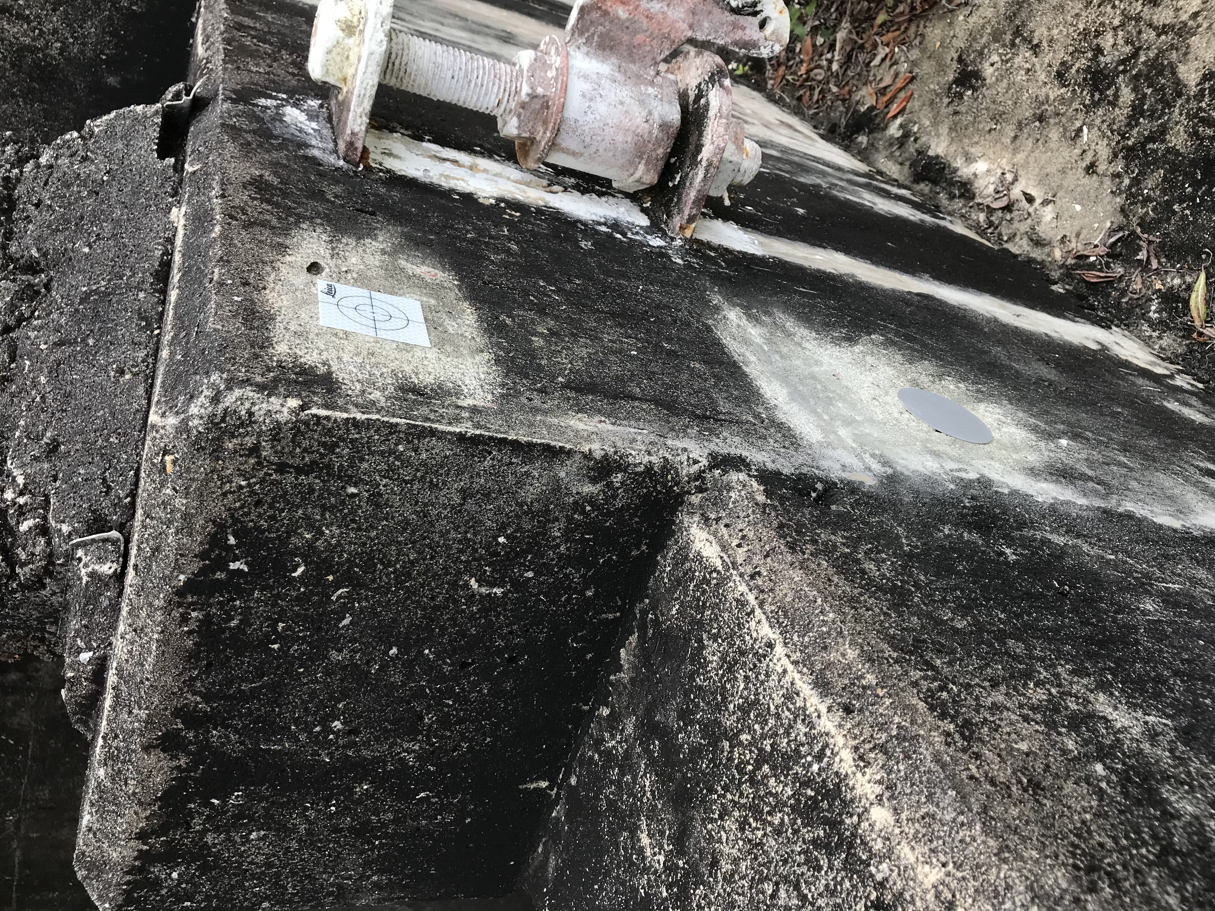
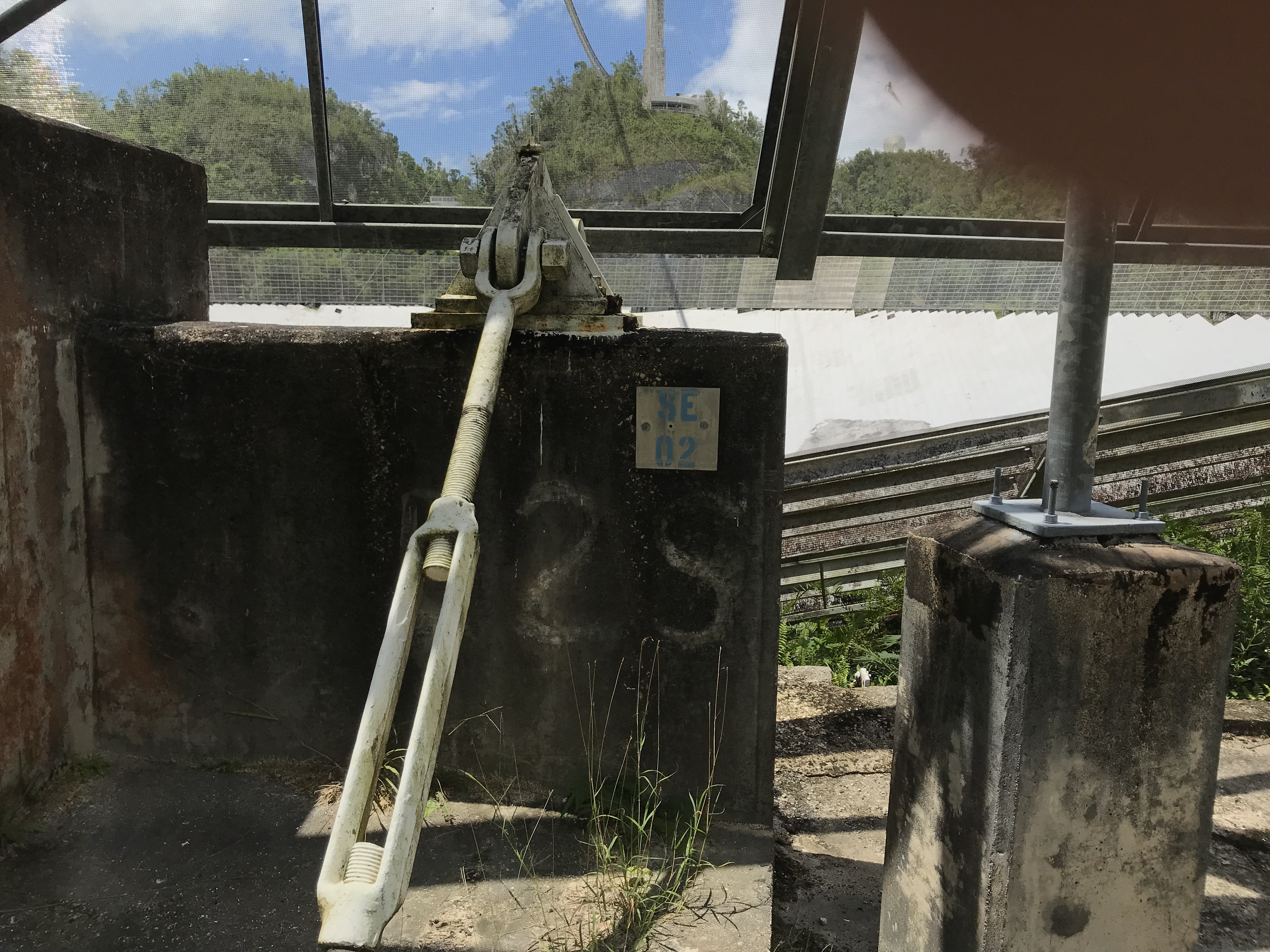
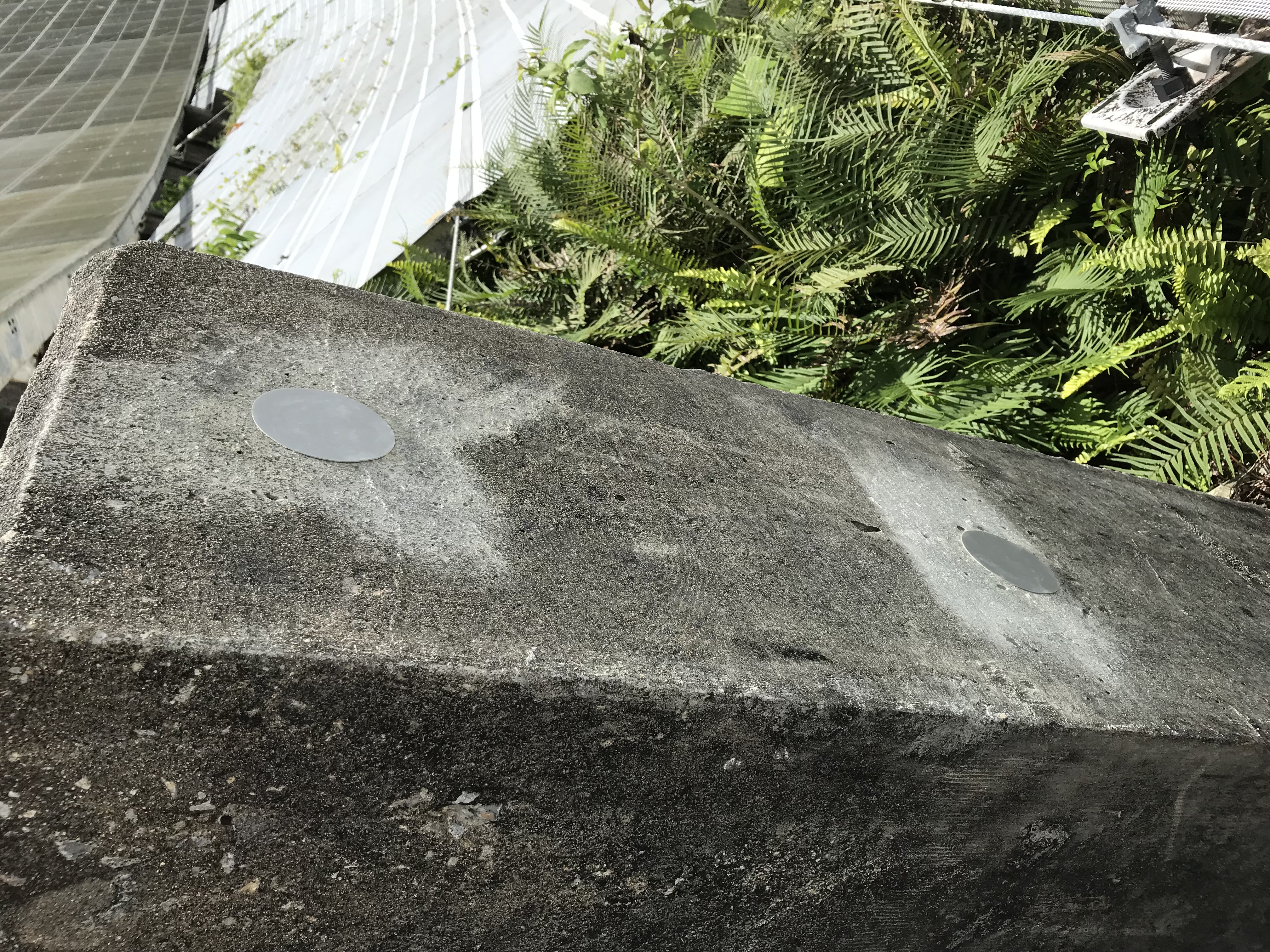
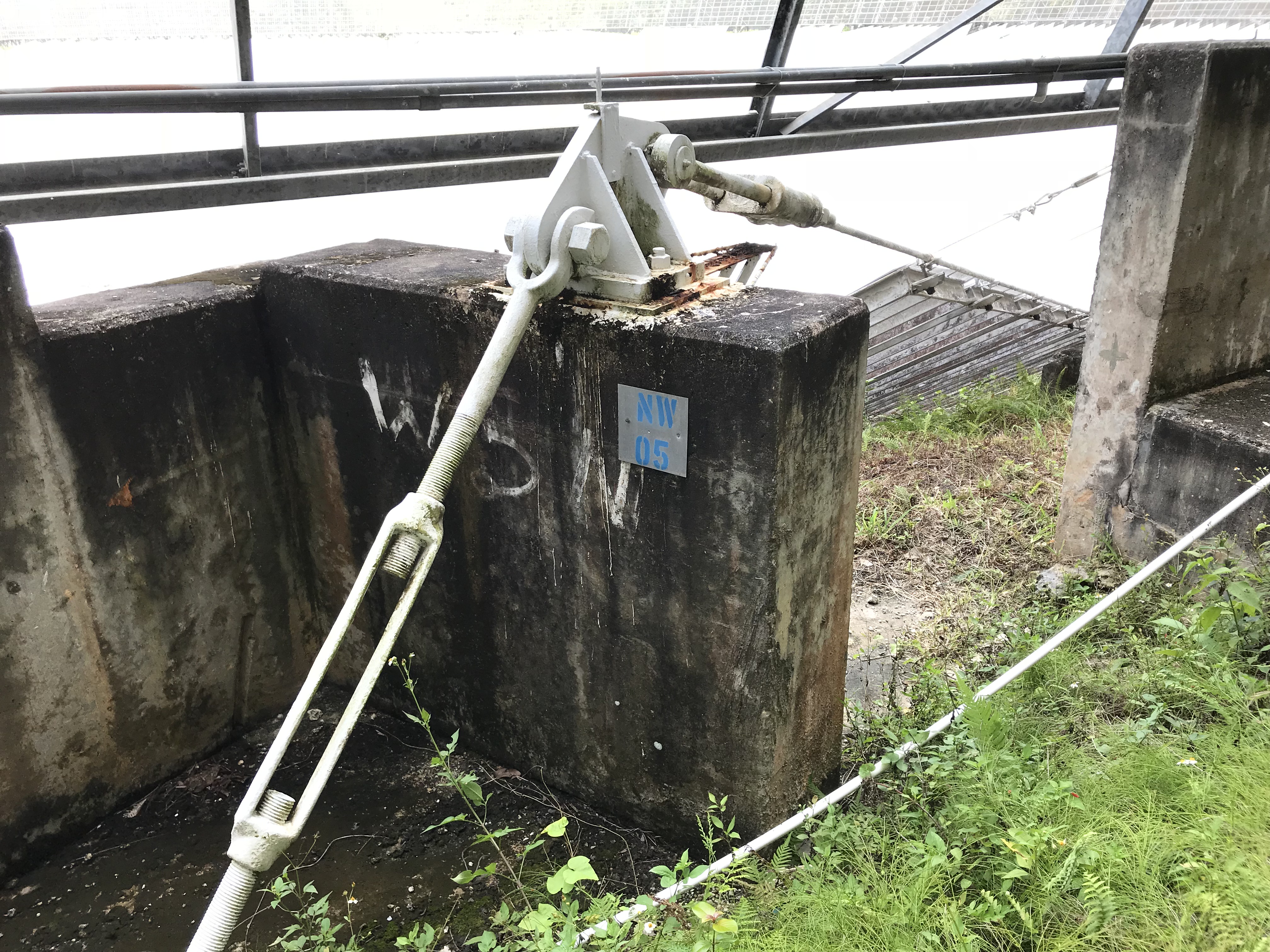
- reflective targets (leica (L) square targets, and round (R) targets that had been used for the photogrammetry survey) were placed around the rim wall
- the targets were placed on the cement blocks near the main cables (the targets were not on the main cables).
- at each spot 2 targets were placed .. (one about 12 -18
inches above the other). We eventually ran out of the (L)
targets. When both types were used, the leica (L) target
was always the upper target.
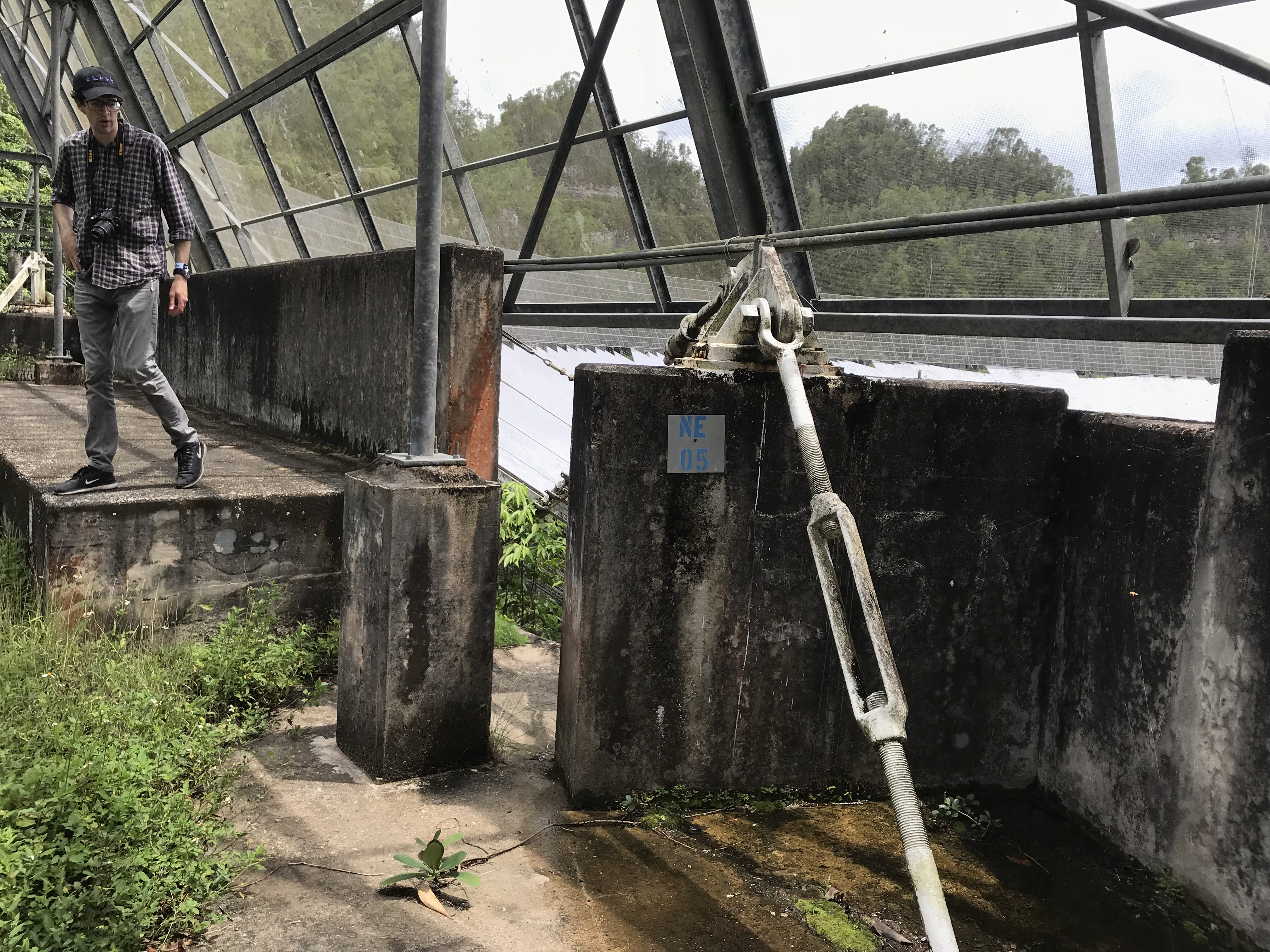
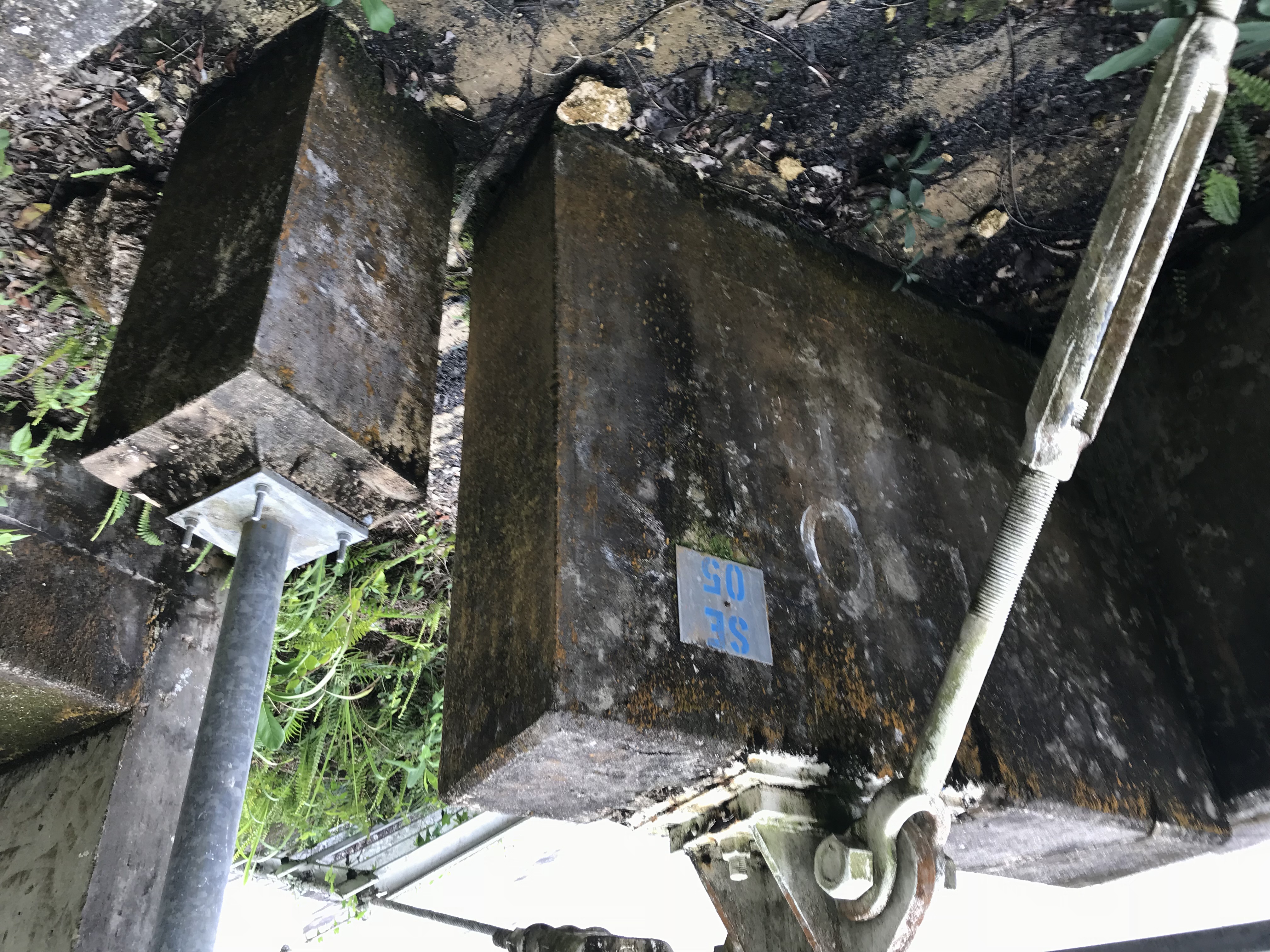
- the locations were:
- NW 02 (L,R)
- NE 02 (L,R)
- NE 05 (L,R)
- SE 02 (R,R)
- SE 05 (L,R)
- SW 02 (X,X)
- NW 05 (L,R)
- These were going to be used to tie the blackmore measurements to AO9.
- The blackmore lidar would see the targets
- We would also measure the targets from A09 using the sokia theodolite.
- Unfortunately, the sokia could not see the targets at the rim wall from AO9.
- We ended up mounting the blackmore scanner atop AO9 (see 24may18)
- the below as pictures of the dish locations, and
the target positioning
- the round targets are about 3" across.
location (.jpg)
targets (.jpg)
NW-02
NW-02
NE-02
NE-02 NE-05
NE-05 SE-05
SE-05
SE-02 SE-02 SW-02
SW-02
SW-05
SW-05
NW-05
NW-05
- Measurements from the visitor center balcony.
- data was taken 18:30 to about 22:00.
- the observations were interrupted many time because of rain.
- 1.5 GHz chirp bandwidth was used.
- The data is in the VisitorCenter_Night1 subdirectory.
- the dish, platform, cables, towers were scanned.
- Pictures from the balcony
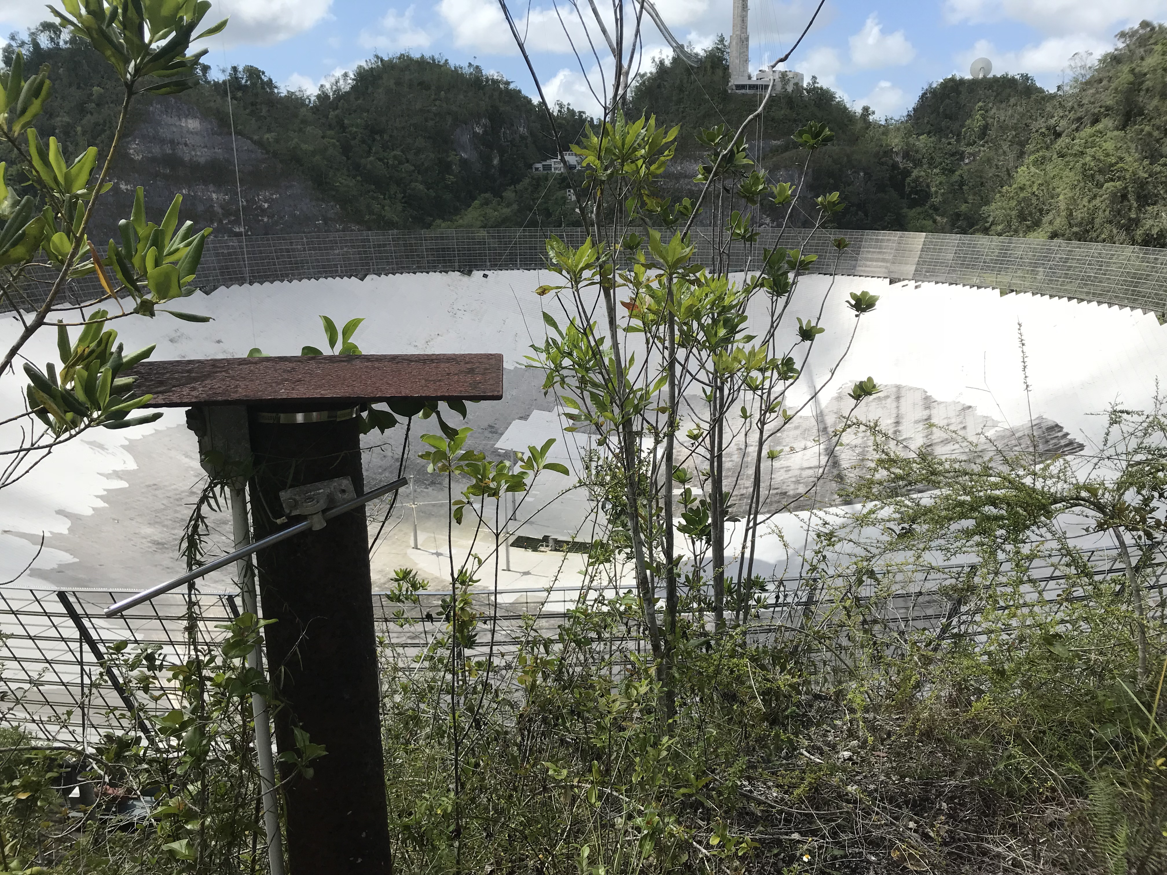
23may18 - road between anchor 4 and gate to river.
- data was taken on the road between anchor 4 and the gate going down to the river.
- The tripod was mounted next to tony acevedo's old camera stand.
- data was taken from 18:00 to around 22:00.. with some breaks for rain,
- the dish, platform (i think), cables, 12meter antenna were all scanned.
- 1.5 GHz chirp was used.
- the data is in the FarSide_Night2 subdirectory.
- pictures from the observing site
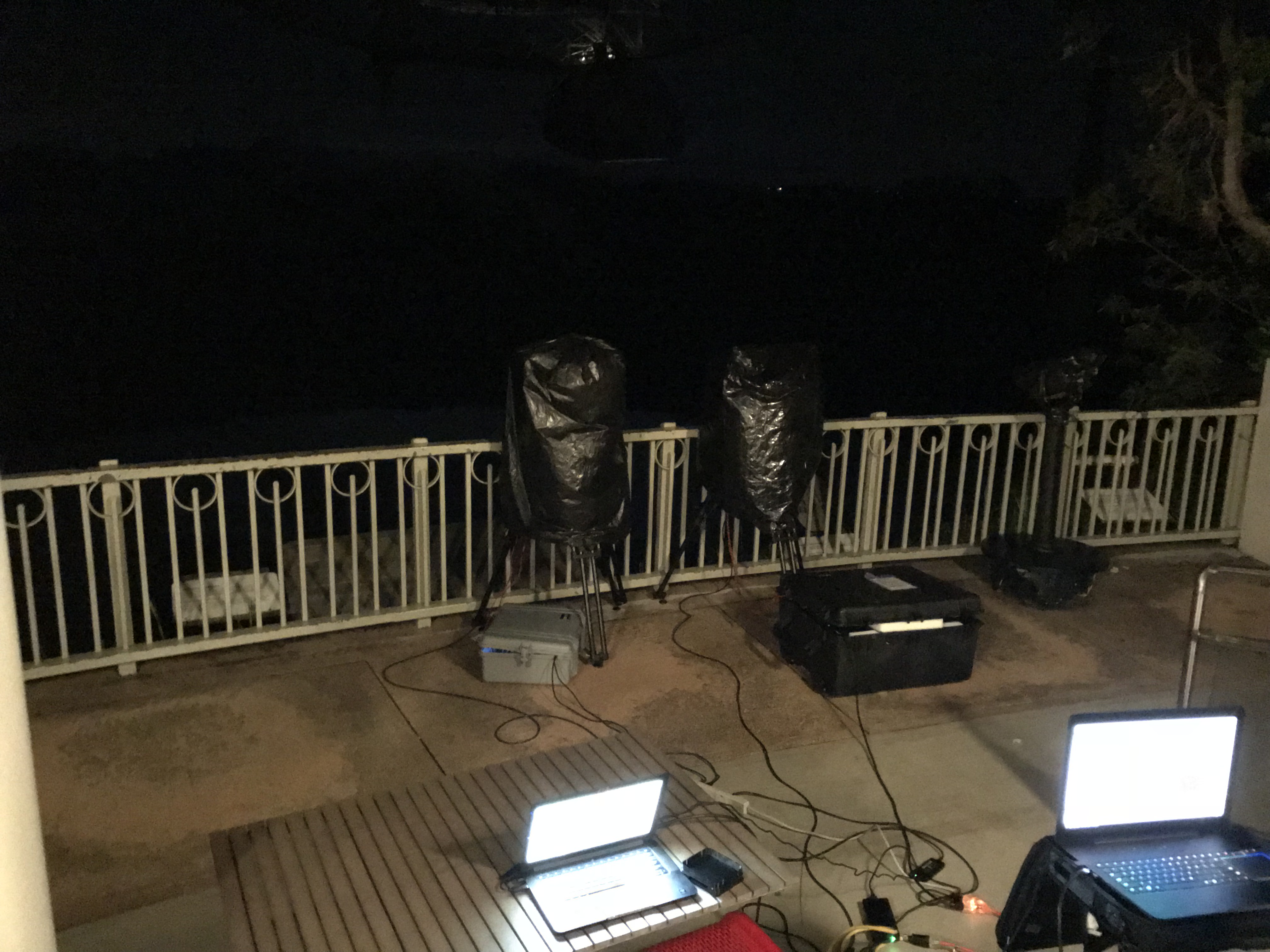
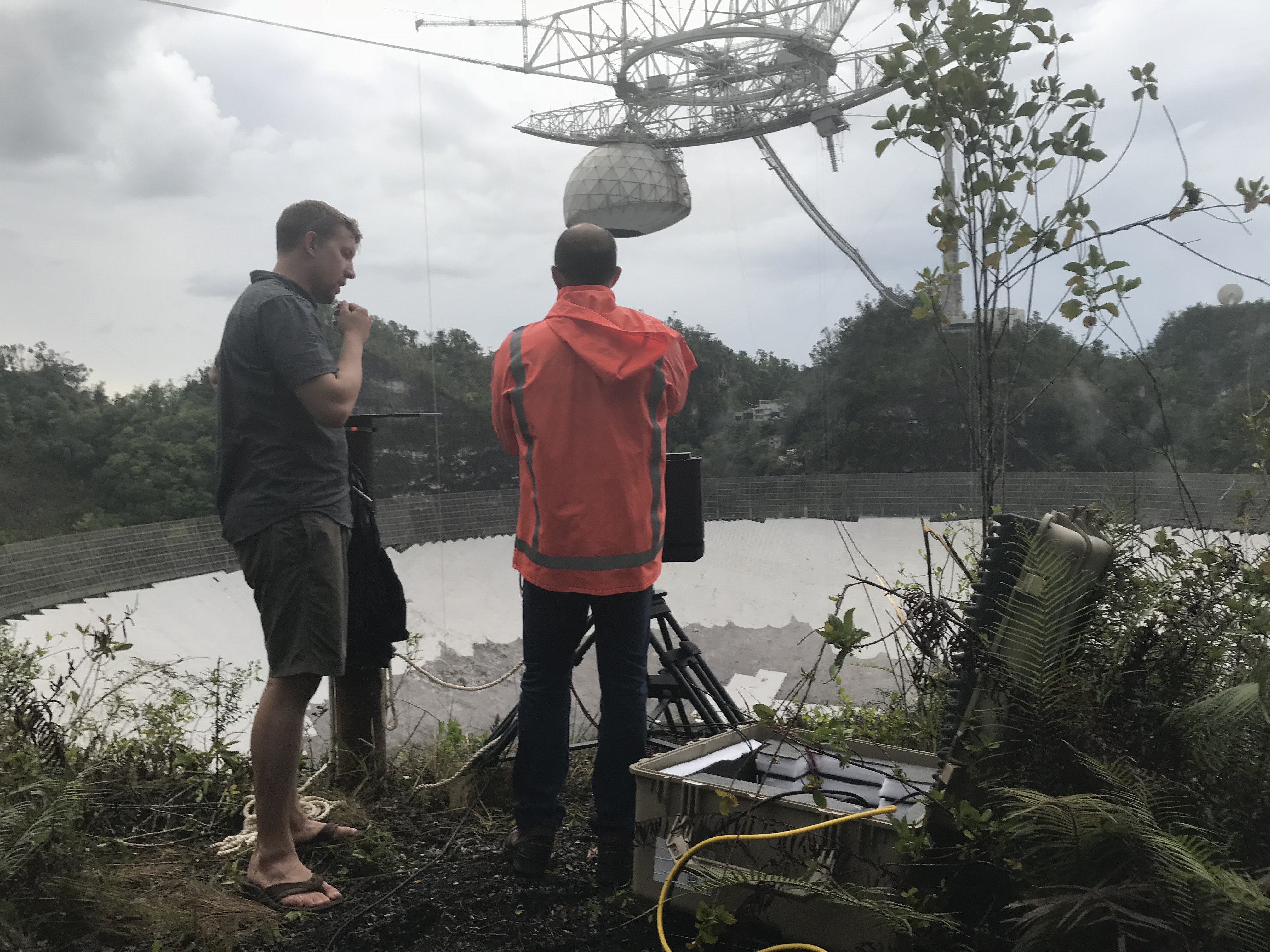
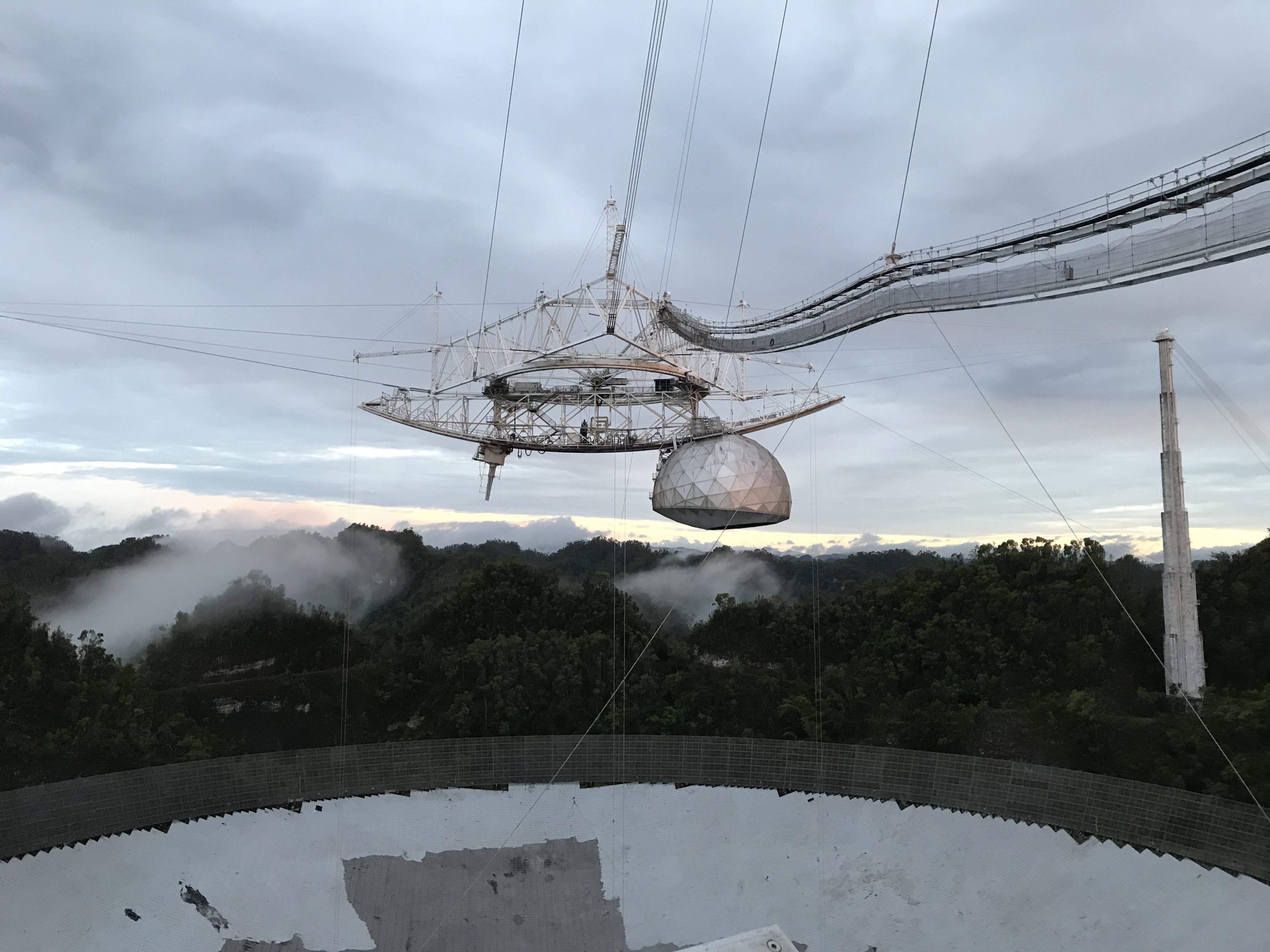
24may18 - AO9 and visitor center.
- scanning from AO9, morning,afternoon
- data was taken starting around 10:00 am till around 14:00
- we built a clamping device to mount their scanner on AO9
- they had a 12"x12" breadboard with mounting holes and a center tap.
- we clamped this to the top of ao9
- a prism mount was used to center the breadboard above ao9
- adjusting screws and levels were then used to level the bread board.
- the top of the breadboard was 1.512" above the top of
ao9.
- this will be the z offset of their measurements relative to the top of ao9.
- 1.5 GHz chirp bandwidth scan. this started around 10:00
am.
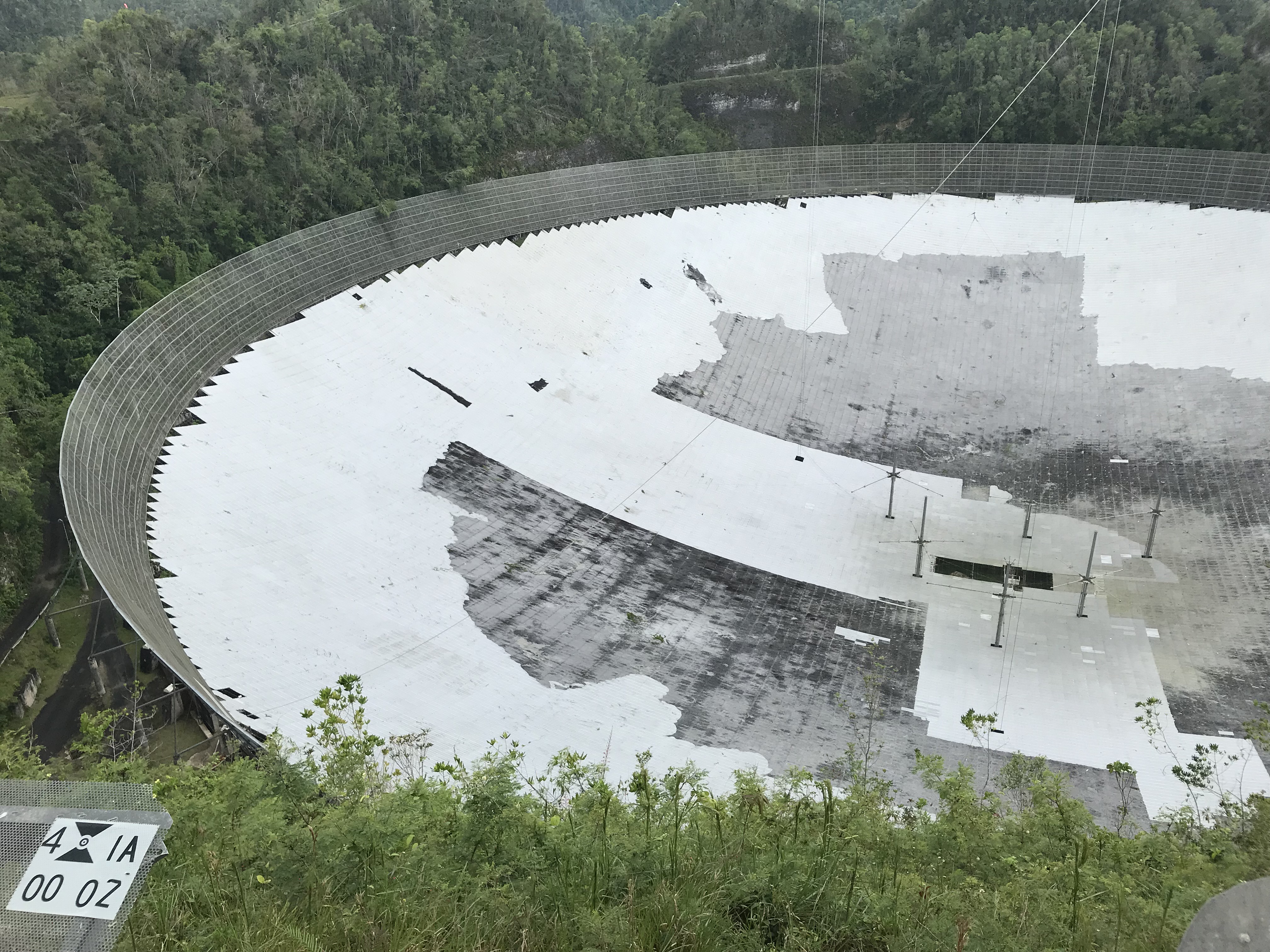
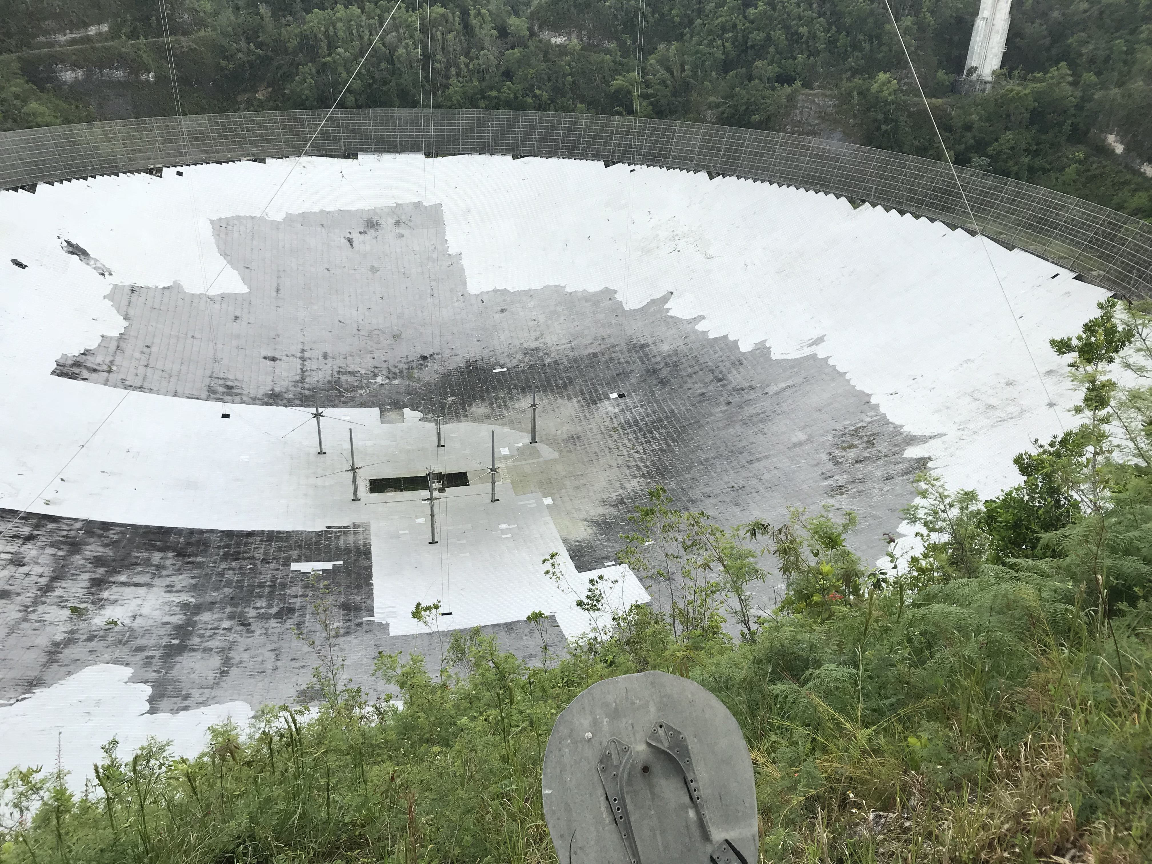
- the dish was scanned. This picked up all of the reflector targets we mounted on the rim wall
- 4GHz chirp bandwidth
- this was started after noon.
- the data is in the subdirectories: AO9_Day3/ao9_1p5G,ao9_4G
- scanning from visitor center balcony.
- This started around 18:00
- the dish was scanned at 3.5 GHz
- This did not make it to the other side of the dish
- The dish was re scanned at 3GHz. this made it all the way across.
- The data is in the subdirectory VisitorCenter_Night3
- See the readme.txt file in that directory.. (to separate out the 3.5 and 3GHz data)
- pictures from the visitor center
Some pictures from scanner location looking toward dish
| From visitors center
balcony Looking south |
left
half |
right
half |
| from t4 anchor - gate to river
road looking north |
left
half |
right
half |
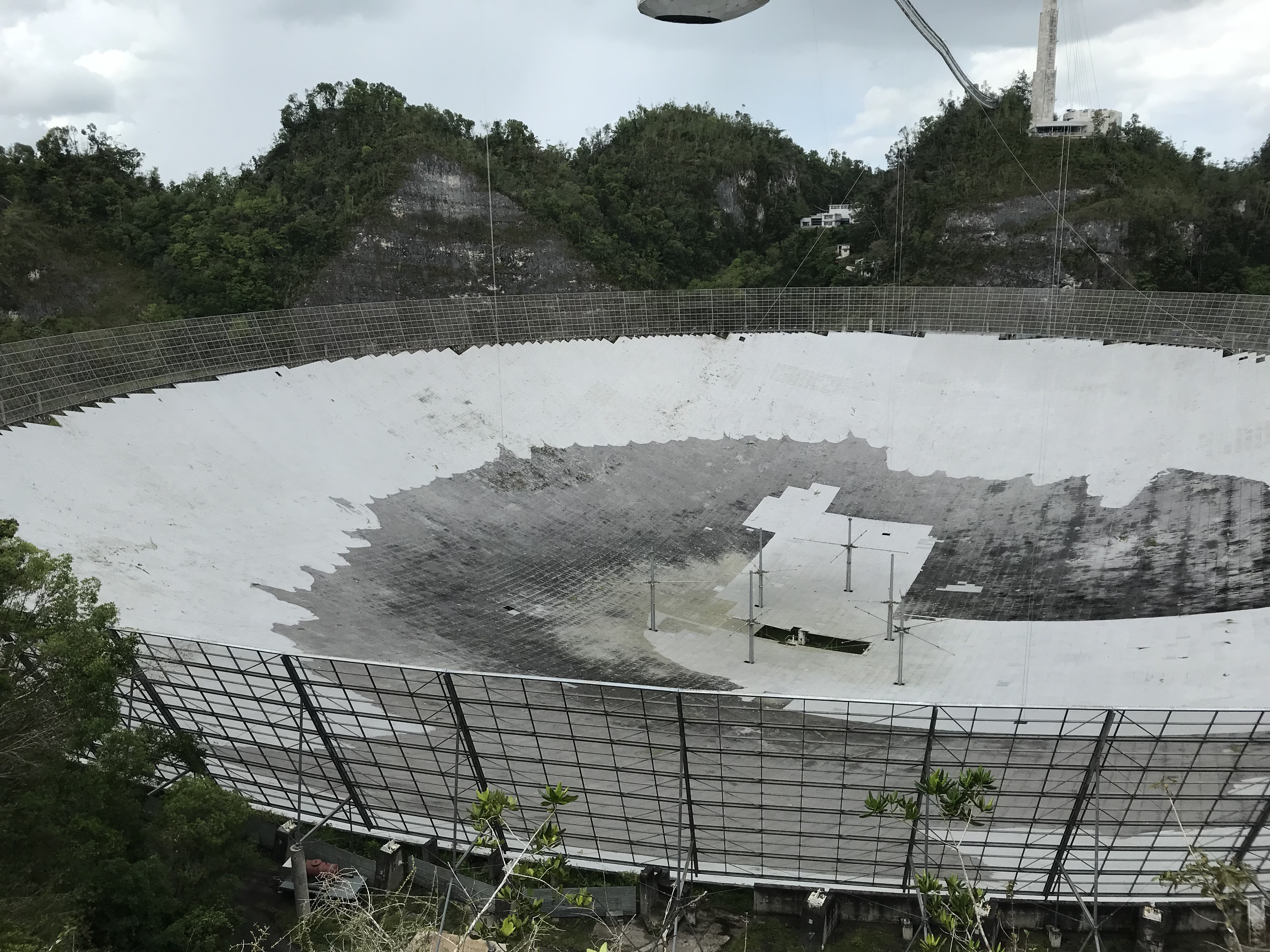
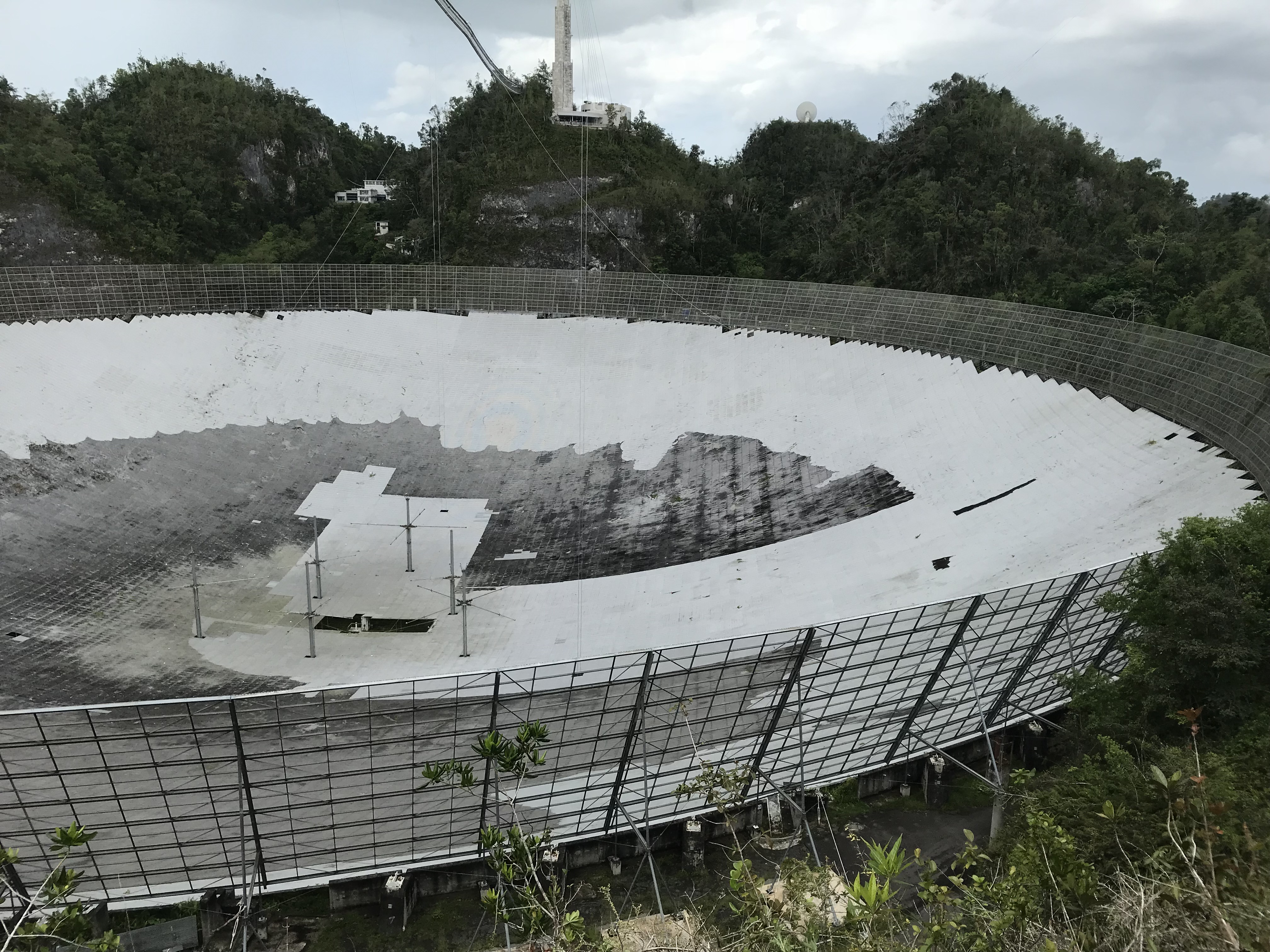
The pictures show the parts of the dish
that have been cleaned.
Some numeric values need for registration:
- base of scanner above ao9: 1.512 inches
- Offset of scanner from center of breadboard
- We measured the distance from the base of the scanner to
the 4 edges

- the scanner was mounted so that the cable face pointed approximately at the lower right corner of the picture
- the 2.954" offset side was probably NNW direction.
- Telescope location for each day:
- we left the telescope at:
- az=270, grza=10, chza=stow (encoder positions, no model correction)
- The tiedowns were disabled before the start of each run,
see also: /share/megs/survey/180521